Spring ![]() Summer
Summer ![]() Fall
Fall ![]() Winter
Winter ![]()
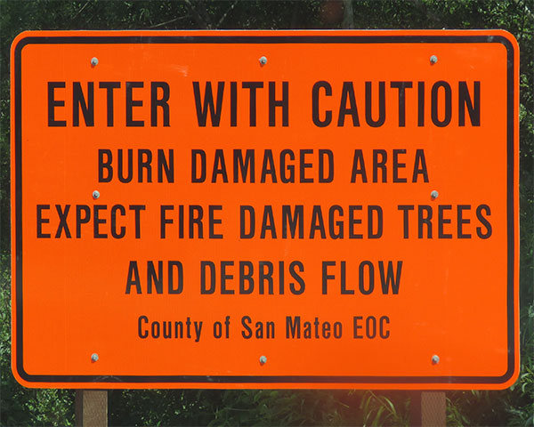
Warning sign posted for the eastern half of Gazos Creek Road, following the CZU Fire of 2020. The road is safe to travel, and a good vantage for observing the changes and regeneration of the forest. However, be cautious for falling limbs and holes created by the fire - best to stay on solid surfaces! Photo taken June 2021 (Jennifer Rycenga)
Gazos Creek Road allows birders access to a ten-mile stretch of forested coastal canyon, beginning at the sea and winding up the western slope of the Santa Cruz Mountains. The junction with Cloverdale Road occurs at 1.8 miles east of SR1 Gazos Creek Road (see separate Cloverdale Road section). Gazos Creek continues as a road for vehicular traffic about another two miles, then ends at a locked gate. From that gate, one can continue along the abandoned road, eventually reaching the small portion of Big Basin State Park located in San Mateo county. Much of the land along Gazos Creek Road, both the active and the abandoned parts, is either private land or undeveloped state park land, birding is generally restricted to the roadside. The best birding on Gazos Creek Road happens in the first 2.5 miles from SR1 to above the junction with Cloverdale Road.
To bird Gazos Creek Road in its first 2.5 miles, use any of the dirt pull-outs along the road. Here you will find yourself entering a cool, moist coastal canyon with hillsides of thick scrub and patches of Douglas Fir and live oaks. The shallow, rocky year-round creek is bordered by a dense riparian woodland of alder, willow and elderberry. A wide variety of ferns, berry vines and flowering shrubs occupy the woodland understory and Spanish moss hangs from oak limbs above, creating a peaceful and luxuriant setting for a day afield. During sunny (and even foggy) summer weekends a moderate amount of traffic may put a damper on pleasurable walking on the road, but in early mornings, weekdays or off-season months, a short hike here can be quite rewarding. Not only will you find birds, but also wildflowers and other forms of wildlife.
Birding is best during the breeding season (March-July) when birds are on territory in full song. Expect to find a thorough representation of typical coastal woodland species. Walking along the road is the best bird-finding strategy, since birds are most conspicuous along the forest edge.
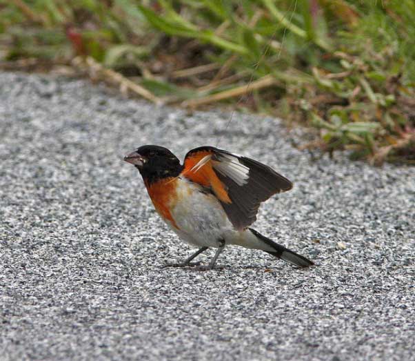
These first two miles of Gazos Creek Road have become legendary in recent years as a prime location for discovering "vagrant" songbirds from eastern North America during spring migration. During late May through early July a dazzling list of eastern species has been recorded. Yellow-throated Vireo and Indigo Bunting, Hooded , Bay-breasted and Yellow-throated Warblers have been recorded and one or two Northern Parulas are found virtually each year. A pair even stayed to nest in 1990 for one of California's few breeding records. Similarly out-of-range, a pair of Rose-breasted Grosbeaks succeeded in nesting here during the 1980's. A male Hooded Warbler formed a pair-bond with a female Wilson's Warbler in 2004, but it is not known what breeding success, if any, they achieved. This area is also exceptional for fall warbler migration; many rarities have been seen here, including Chestnut-sided, Black-and-white, Tennessee, and Black-throated Green Warblers; nearly anything is possible.
Gazos Creek Road will come to a junction 1.8 miles inland with Cloverdale Road. The junction itself has some excellent areas of riparian; this is one of the first places to look for migrants and vagrants in spring and fall. Just past the junction, there is a dirt road to your right: Old Woman Creek Road. This road can be walked a fair distance; it parallels its eponymous creek for about 1.5 miles. There are residences along this road in its higher reaches, so respect private property. However, Old Woman Creek Road is legitimately part of Año Nuevo State Park. There is a metal bridge across Gazos Creek just a few yards from Gazos Creek Road; this is one of the best spots to look and listen for MacGillivray's Warbler when it is singing in May and June.
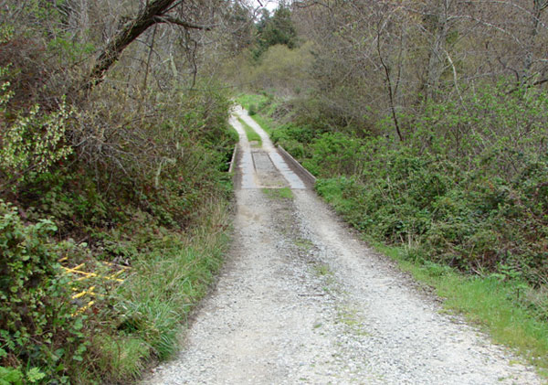
Continue on Gazos Creek Road as it ascends gradually into the Santa Cruz Mountains. About 1/10th of a mile east of Old Woman Creek Road, there is a small trail sign on your left; the trail peters out quickly, but takes you to some interesting habitat. This is officially part of Butano State Park. From the road by the trail marker, listen carefully for Northern Pygmy-Owl near dawn and dusk; this is the place where it is heard most often. As you drive further east, the next large pullout to your right is an excellent spot for Western Screech-Owl and Northern Saw-whet Owl. The further east you drive past this point, the steeper and narrower the canyon becomes, as the coniferous forest becomes deeper and darker. The bird life in these woods is not as varied or as abundant as below, but there is a possibility of some of the rarer deep forest birds here (there are sightings of both Pileated Woodpecker and Spotted Owl). American Dippers nest in some years along the turbulent, rocky stretches of the creek and Hermit Warblers and Hermit Thrushes nest on the higher ridges. Note that the portion of Gazos Creek Road beyond the former Villa Cathay Camp (5.3 miles from the beginning of the road) is unpaved dirt, and is not open to vehicular traffic at this time. Hiking this portion of the road will eventually lead you to the border with Big Basin State Park, which is primarily located in Santa Cruz County.
Owling anywhere and during any season along Gazos Creek Road can be excellent. Because this is a public road, with no residences along its lower stretches, it creates ideal owling conditions. Great Horned Owls and Northern Pygmy-Owls are resident in mixed woodlands, Western Screech-Owls in oaks, Northern Saw-whet Owls in deep coniferous forests, and Barn Owls in grassy clearings (Barn Owls are easier to spot along the first two miles of Cloverdale Road from the junction with Gazos Creek). Both Spotted Owl and Long-eared Owl have been heard along Gazos Creek Road, albeit very rarely.
Other wildlife present includes Coyote, Bobcat, Deer, California Newt, and numerous snakes.
Year-round residents
Hooded Merganser (uncommon at this location), Western Screech-Owl, Great Horned Owl, Northern Saw-whet Owl, Northern Pygmy-Owl, Anna's Hummingbird, Band-tailed Pigeon, Belted Kingfisher, Acorn Woodpecker, Downy Woodpecker, Hairy Woodpecker, Pileated Woodpecker, Northern Flicker, California Quail, Cooper's Hawk, Black Phoebe, Pygmy Nuthatch, Brown Creeper, Pacific Wren, Wrentit, Hutton's Vireo, Common Yellowthroat, Purple Finch, Pine Siskin.Summer residents
Vaux's Swift (uncommon), White-throated Swift (uncommon), Allen's Hummingbird, Olive-sided Flycatcher, Western Wood-Pewee, Pacific-slope Flycatcher, Violet-green Swallow, Northern Rough-winged Swallow, Swainson's Thrush, Warbling Vireo, Orange-crowned Warbler, Wilson's Warbler and Yellow Warblers, MacGillivray's Warbler (uncommon but present), Black-headed Grosbeak, Grasshopper SparrowWinter residents
Red-breasted Sapsucker, Say's Phoebe, Red-breasted Nuthatch, Golden-crowned Kinglet, Ruby-crowned Kinglet, Varied Thrush, Hermit Thrush, Townsend's Warbler, Lincoln's Sparrow, Red Crossbill (uncommon)Migrants
Hermit Warbler, Western Tanager, Lazuli Bunting, Lark Sparrow
In this guide, "rarities" are defined as those species given an County Abundance Code of 4, 5, or 6.
White-winged Dove (2015), Bald Eagle (2010), Golden Eagle (2013), Broad-winged Hawk (2022), Long-eared Owl (2009, 2013, 2015), Common Poorwill (2010, 2013), Rufous Hummingbird (2016), Black Swift (always possible spring-fall), Red-naped Sapsucker (2014, 2016), Yellow-bellied Sapsucker (2010, 2017), Sulpher-bellied Flycatcher (1998), Least Flycatcher (2015), Hammond's Flycatcher (2011, 2018, 2021), Scissor-tailed Flycatcher (1974), Yellow-throated Vireo (1990), Cassin's Vireo (2018), Blue-headed Vireo (2012), Red-eyed Vireo (2021), American Dipper (2010, 2018), Purple Martin (2010), Townsend's Solitaire (2013), Philadelphia Vireo (2017), Brown Thrasher (2013), American Redstart (2013, 2016, 2018, 2022, 2023), Tennessee Warbler (2014, 2017, 2023), Northern Parula (2017), Hooded Warbler (2004, 2017), Chestnut-sided Warbler (2009, 2014, 2016, 2017, 2018, 2020, 2022, 2023), Yellow-throated Warbler (1993), Blackburnian Warbler (2018, 2021, 2023), Blackpoll Warbler (2014, 2016, 2023), Prairie Warbler (2023), Palm Warbler (2013, 2016), Black-and-White Warbler (2016, 2017, 2019, 2022, 2023), Canada Warbler (2011, 2014), Northern Waterthrush (2012), Nashville Warbler, Magnolia Warbler (2016), Kentucky Warbler (2020), Chipping Sparrow (2011), Black-throated Sparrow (2020), Swamp Sparrow (2011, 2018), White-throated Sparrow (2012, 2016, 2018), Clay-colored Sparrow (2018), Rose-breasted Grosbeak (nearly annual), Indigo Bunting (2015), Evening Grosbeak (2010), Lawrence's Goldfinch (2022)
Gazos Creek Road runs east from SR 1. To reach Gazos Creek Road, drive south on SR 1, and look for Gazos Creek on your left about 8 miles south of the intersection of Pescadero Creek Road and SR1. There is a gas station and a restaurant at the corner of Gazos Creek Road and SR1. Gazos Creek Road can also be reached by traveling the length of Cloverdale Road from Pescadero; Cloverdale Road ends at Gazos Creek Road, a little less than 2 miles east of SR1.
Red Markers: Parking Area or Trail Head
Hover mouse pointer over marker, or click marker, for pin identification.
Use + or - buttons to change map zoom. Click & Drag to pan.
24/7. It's a road! The dirt pullouts can even help ensure safety while owling.
Ticks are plentiful here, becoming especially voracious in late spring and early summer. They will literally line up on a roadside blade of grass, just waiting for birders to approach! Poison oak is also present; look before you leap! Human-caused problems center on traffic; the road is particularly popular with people in fast sports cars and motorcyclists. Less noisy, but still sometimes unnerving, this road is also very popular with mountain bikers. Their quieter presence gives you ample reason to look where you are going as you cross or enter the road.
There is a restroom at the Gazos Creek Beach Coastal Access and the park rangers at Butano State Park will usually waive the entrance fee for those needing to use the restrooms at the first parking lot. (Please do not abuse this privilege as some of us value it quite highly.) The restaurant (Gazos Grill), a gas station and its accompanying minimart, located at the intersection of Gazos Creek Road and SR1, are now open regularly, and you can also find food, drink, and fuel in Pescadero. Camping and picnic facilities are available at nearby Butano State Park.
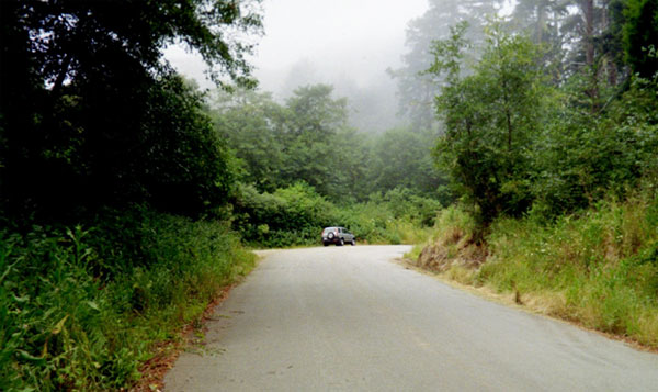
Gazos Creek Road is paved, but narrow and windy. However, the frequent pull-outs do make this an accessible spot for people with mobility limitations. Old Woman Creek Road is well-packed dirt, with very little traffic; it is likely inaccessible for people in wheelchairs, but for a person using a cane or crutches, access is possible. For people with visual impairment, if you can get a ride to this location (it is not on any mass transit grids), this is one of the best birding-by-ear locations in the county, especially in spring.
Because the road is public, there is no official contact information. However, parts of the road give access to land that is officially part of Año Nuevo, Butano, and Big Basin Redwoods State Parks. Contact information for those parks can be found in separate entries on this website.
Gazos Creek has three logically demarcated hotspots in eBird, and one specialized offshoot. The basic one, Gazos Creek Rd.--east of Hwy 1 to Cloverdale Rd. Intersection, has data for every time quadrant, and contains a whopping 208 species. The eBird site for the eastern half of the road Gazos Creek Rd.--east of Cloverdale Rd intersection to 5 miles upstream includes 145 species in 46 of 48 time quadrants. There is a subsidiary spot for the Gazos Creek Mountain Camp--meadow. It has data in a mere five of forty-eight time quadrants, representing 26 species. The final one, Old Woman's Creek Rd. - State Park property - Gazos Creek Rd to gate, covers 78 species in 27 of 48 time quadrants.
Sequoia Audubon Society has led 19 field trips to Gazos Creek Road over the years.
Gazos Creek Road, especially its upper regions, was affected by the CZU Complex Fires in August-September 2020. Please join the iNaturalist project charting the response to this fire - the largest in southwestern San Mateo county in over a century - by visiting its home page here.
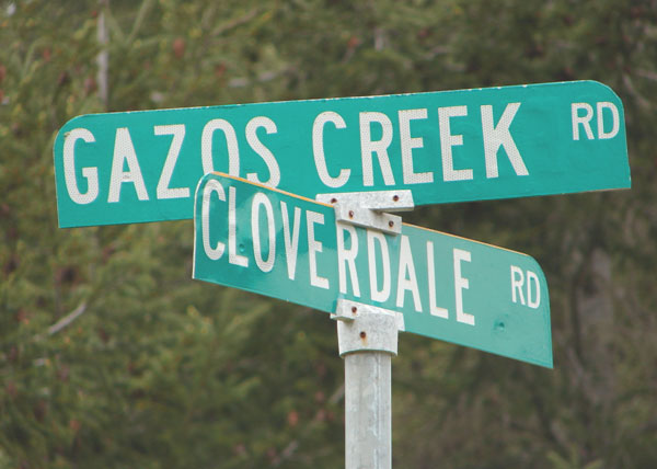
The Junction of Gazos Creek and Cloverdale Roads (Jennifer Rycenga)
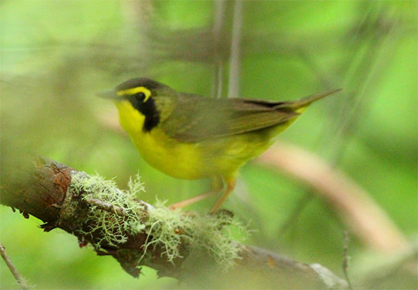
Kentucky Warbler, one of the rarest of the east coast Warblers to find in California, in June 2020 (Alex Rinkert)
Black-throated Sparrow in migration along Gazos Creek Road, October 2020 (Joshua Stacy)
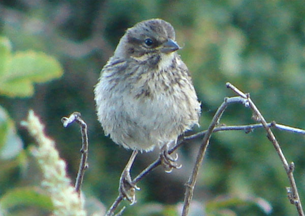
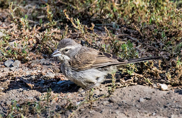
Juvenile Song Sparrow, Gazos Creek Road (Jennifer Rycenga)
Old Woman Creek Road, looking south from Gazos Creek Road. Note the metal bridge over Gazos Creek (Jennifer Rycenga)

Immature Hutton's Vireo, June 2012, Gazos Creek Road (Jennifer Rycenga)
Gazos Creek Road looking west, pullout (with car) located just east of the "Dip" signs; this area is the best location along the road for Acorn Woodpeckers; it has also been a reliable location for hearing Northern Saw-whet Owls (Jennifer Rycenga)
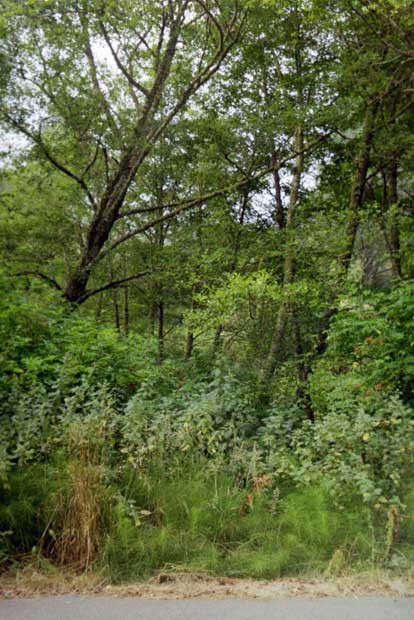
Gazos Creek Road riparian habitat, much loved by warblers (Jennifer Rycenga)
Hybrid Rose-breasted/Black-headed Grosbeak, returning for its second year at the Gazos Creek Pump House, July 2010 (Dan Singer)
Author: Peter J. Metropulos
Uploaded:
March 17, 2009
Last Update:
September 25, 2023 6:02am.
Updated by: Jennifer Rycenga
All content ©Sequoia Audubon Society and others
No use without written permission