 Summer
 Fall
Winter

Spring
Summer
Fall
Winter
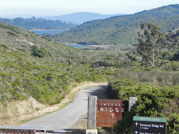
Paved Sweeney Ridge Trail, looking out to the Crystal Springs Watershed. August 2011 (Jennifer Rycenga)
Sweeney Ridge presents one of the most beautiful hikes in the Bay Area. The northern shore of the Crystal Springs Reservoir, a.k.a. San Francisco Watershed, opens below you, and panoramic views of the ocean and the entire Bay Area, even to San Jose on a clear day, are breathtaking. From a birding point-of-view, the Ridge is something of a mono-habitat, but an impressive one of continuous chaparral. The area holds promise for viewing migrant raptors.
The principal eastern access to Sweeney Ridge begins at the end of Sneath Lane in San Bruno. From either El Camino Real, Skyline Boulevard in San Bruno, or Interstate 280 take Sneath Lane west to where it ends at a locked gate. There is parking space for a small number of vehicles in a small paved parking lot. The road is narrow at this point and if you have a larger vehicle, such as a mobile home, you may find it difficult to turn around.
The area beyond the gate is part of the San Francisco Watershed and public access was previously prohibited. In late spring of 1984 the prohibition was lifted to the extent of allowing foot traffic along the paved road that leads to the top of Sweeney Ridge and the Portola Discovery Site. The area is now officially a part of the Golden Gate National Recreation Area.
This area is a good example of relatively undisturbed coastal chaparral habitat. The paved road winds its way at a relatively easy grade approximately 1.5 miles. There is one moderately steep but short stretch. On a clear day the views of the San Francisco Bay and the peninsula are spectacular, with the panorama stretching from the outskirts of San Jose in the south to Mt. Diablo to the east. These views alone are well worth the climb. From the top of the ridge, you can look out over the ocean to the Farallon Islands, Point Reyes, and Mount Tamalpais to the northwest. A barbed wire fence parallels the road for most of its length, defining the limits of public access. But the density of the chaparral and the presence of poison oak form a more formidable barrier to all but the most dedicated or foolhardy trespasser. The area is managed as a wildlife refuge by the state Department of Fish and Game and deer, skunks and raccoons are abundant. Mountain Lion are known to be resident in the watershed.
The bird life is typical of coast chaparral. Wrentit, Bushtit, California Towhee and White-crowned Sparrow are abundant at all seasons. Anna's and Allen's Hummingbirds, Red-tailed Hawk, Wilson's Warbler, Bewick's Wren, Song Sparrow, Spotted Towhee, California Scrub-Jay, Band-tailed Pigeon, American and Lesser Goldfinches, House Finch, Turkey Vulture and California Quail have been identified as nesting species. Common Yellowthroat nest in the marshy area at the beginning of the trail, and Black-headed Grosbeak can be heard singing in the spring. California Thrasher are uncommon but have been heard around the parking lot. In April of 2007, a Common Poorwill, presumably a migrant, was heard along the ridge walk.
Those who are unfamiliar with our coastal climate should be warned to expect as much as a 20-degree difference in temperature between the sheltered areas near the gate and the ridge top, particularly when fog is rolling in. There is also a coastal access to this site. For more details on the site and its historical significance, see the Sweeney Ridge - Pacifica (Western) Access description in this guide.
There is another entrance to Sweeney Ridge at Skyline College. Park in the designated spaces there in Parking Lot C. This gives you access to the Notch Trail. This trail has some limited conifers in addition to the coastal chaparral. It features an impressive array of views, especially looking north across Milagra Ridge and to the Pacifica shoreline. The highlight for the history buff here is the U.S. Coast Guard Station NMC, about halfway along the trail. This trail will test your endurance with steep ascents and descents, including over 200 stairs! The trail can be taken all the way to the Portola Discovery Site. Your options are clearly signed at the end of the Notch Trail. The Mori Point Trail can be easily picked up at this point, giving you a downhill hike to the beach of a little under two miles. This trail also leads to the Shelldance Orchid Nursery (parking and bathroom). That section of the trail is treated in the Pacifica access section.
If you have a few minutes to spare you may want to check the grounds of Skyline College. The vista point at the furthest western end of the campus has an informative storyboard about the 1906 San Francisco Earthquake, whose epicenter was actually in the Pacifica area (near Mussel Rock; see entry in this guide). This overlook provides a view of Pacifica and the grassy hillsides below. South of the campus there are a number of student parking lots surrounded by conifers. These can be worth a quick look for woodland birds and migrants.
California Quail, Turkey Vulture, Sharp-shinned Hawk, Cooper's Hawk, Red-tailed Hawk, American Kestrel, American Coot, Western Gull, Anna's Hummingbird, Allen's Hummingbird, Mourning Dove, Great Horned Owl, Vaux's Swift, Hairy Woodpecker, Downy Woodpecker, Northern Flicker, Loggerhead Shrike (rare at this location), Black Phoebe, Ash-throated Flycatcher (uncommon), Hutton's Vireo, California Scrub-Jay, Common Raven, Violet-green Swallow, Barn Swallow, Chestnut-backed Chickadee, Pygmy Nuthatch, Bushtit, Bewick's Wren, Ruby-crowned Kinglet, American Robin, Hermit Thrush, Swainson's Thrush, Wrentit, California Thrasher, Northern Mockingbird, Orange-crowned Warbler, Common Yellowthroat, Wilson's Warbler, Spotted Towhee, California Towhee, Savannah Sparrow, Fox Sparrow, Song Sparrow, White-crowned Sparrow, Golden-crowned Sparrow, Dark-eyed Junco, Western Meadowlark, Brewer's Blackbird, Red-winged Blackbird, Brown-headed Cowbird, House Finch, Purple Finch, Red Crossbill, American Goldfinch, Lesser Goldfinch
In this guide, "rarities" are defined as those species given an County Abundance Code of 4, 5, or 6.
Common Poorwill (very rare, migration), Western Kingbird (2017)
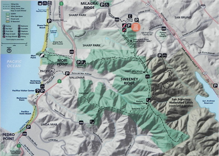
From El Camino Real (Hwy. 82), (Approx. three miles), Interstate 280 (two miles) or Skyline Boulevard (one mile) in San Bruno, take Sneath Lane west to where it ends in a small paved parking lot with a locked gate. You may note an isolated and forbidding-looking building to the right as you proceed on Sneath Lane. This is the San Francisco City jail, about eight miles south of the San Francisco city limits.
To get to the Skyline College entrance, take Sharp Park Road from either Pacifica or I-280, then turn south on College Road (this is directly across the street from the main entrance to Milagra Ridge). When you reach the entrance to the college's loop road, turn right. The pullover/lookout on your right now holds a 2006 storyboard commemorating the 1906 earthquake. Continue to Parking Lot C. Towards the back of the lot, on your right, is a storyboard and trailhead for Sweeney Ridge, with four dedicated GGNRA parking spaces.
Red Markers: Parking Area or Trail Head
Hover mouse pointer over marker, or click marker, for pin identification.
Use + or - buttons to change map zoom. Click & Drag to pan.
This section of the Golden Gate National Recreation Area is free.
Officially the area is open from dawn to dusk. The parking lot at Skyline College closes and is locked at 7:00 P.M.: keep this in mind if hiking from this point.
Ticks are present; Mountain Lions are known to reside in the watershed. Do not leave valuables in your car.
There are no facilities on Sweeney Ridge itself. Gas stations and restaurants can be found in San Bruno.
Accessibility information is currently not available for this location.
Golden Gate NRA - Pacific West Region Information Center: (415) 561-4700
"Sweeney Ridge" is a hotspot in eBird, but with data in only 12 of 48 time quadrants. Bolster our collective avian knowledge of this and all sites by recording your observations in eBird.
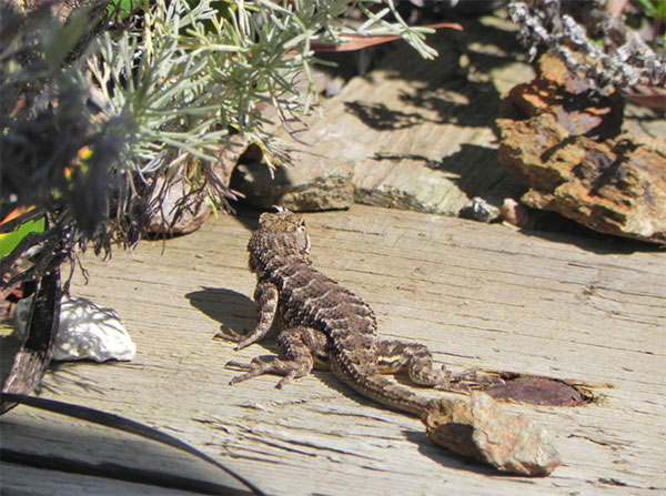
Western Fence Lizard soaking up the sun on a rare fog-free afternoon. Sweeney Ridge, Notch Trail, August 2011 (Jennifer Rycenga)
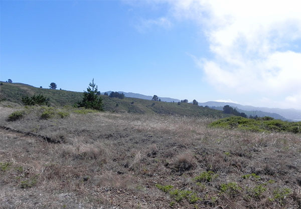
Vista provided along the Notch Trail, Sweeney Ridge, August 2011 (Jennifer Rycenga)
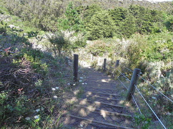
Stairs along the Notch Trail, Sweeney Ridge, August 2011 (Jennifer Rycenga)
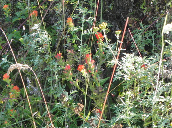
Indian Paint Brush, Sweeney Ridge, August 2011 (Jennifer Rycenga)
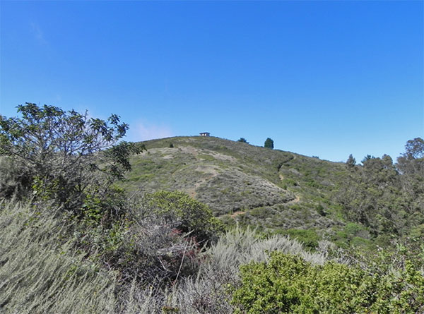
Historic U.S. Coast Guard Station NMC, looking northeast from the Notch Trail, Sweeney Ridge, August 2011 (Jennifer Rycenga)
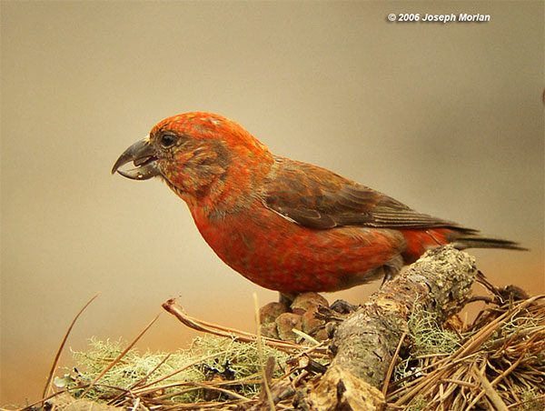
Red Crossbill (male), Skyline College entry to Sweeney Ridge, July 2006 (Joe Morlan)
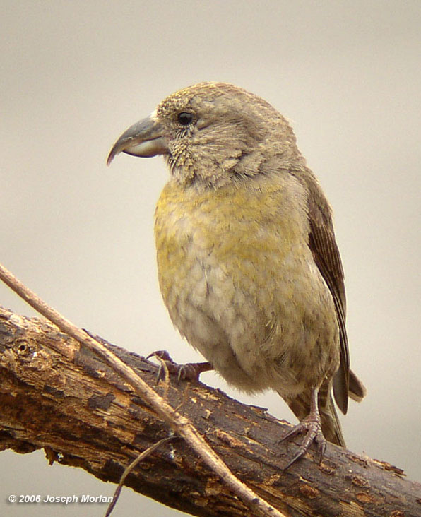
Red Crossbill (female), Skyline College entry to Sweeney Ridge, July 2006 (Joe Morlan)
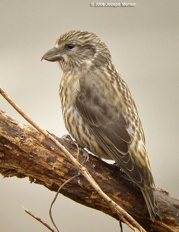
Red Crossbill (juvenile), Skyline College entry to Sweeney Ridge, July 2006 (Joe Morlan)
Author: Cliff Richer
Uploaded:
March 25, 2009
Last Update:
May 14, 2022 10:22pm.
Updated by: Carol Miller, later updates by Jennifer Rycenga
All content ©Sequoia Audubon Society and others
No use without written permission
