 Summer
Fall
Winter
Spring
Summer
Fall
Winter
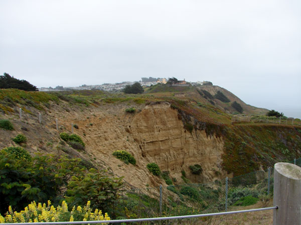
One of the eroding cliffs at Thornton State Beach, May 2009 (Jennifer Rycenga)
Thornton State Beach occupies the northern third of the coastline in Daly City. This was a very popular beach site in the mid-twentieth century. However, erosion from the El Niño year of 1982 caused severe damage to the park road and facilities, leading to the park's closure. The San Andreas fault runs through this area, only a quarter of a mile from the park. In the 1989 Loma Prieta earthquake, the unstable semi-consolidated sedimentary rock in this area of the coast was further damaged, setting back the timetable for reopening the park indefinitely. Looking at some of the houses to the south, perched on land that looks like it, too, could buckle at any moment, alerts you to the dangers of the site.
In 2005, Daly City opened an overlook where the park's entry road once was located; this is the only current legal public access to this site. There is coastal scrub at the overlook, which hosts a year-round population of White-crowned Sparrows, but there are no extensive birding opportunities at this site. You are too far from the ocean to do any seabirding other than the most cursory (Mussel Rock to the south is much better, and nearby Fort Funston is the best seawatching spot in San Francisco, so don't despair!). The storyboards at the overlook provide some excellent background, though, on the natural and human history of the park.
The site is included here for two reasons: first is the hope that one day it will re-open, and the San Mateo birding community will be ready to document what they see here. The second reason is to celebrate San Mateo's rarest bird ever, which happened here just before that fateful year of 1982. The only state record ever of Least Auklet was a lone individual who washed up here in an emaciated condition, on June 15, 1981. It died overnight at the Humane Society rehabilitation center in San Mateo, but it was saved as a specimen, verified, and studied.
If you make a stop here, you are not only very close to Mussel Rock Park (see entry in this guide), but also to San Francisco's Lake Merced, an area often blessed with rarities, as well as a good summering population of Bank Swallows. In fact, the same conditions that allow the Bank Swallows to thrive at Fort Funston in the city likely persist along the unseen cliffs of Thornton, making this uncommon county breeder a bird to keep in mind while birding the overlook.
Canada Goose, Brant, Surf Scoter, Black Scoter, Red-throated Loon, Western Grebe, Clark's Grebe, Brandt's Cormorant, Turkey Vulture, Red-tailed Hawk, Red-shouldered Hawk, White-tailed Kite, Marbled Godwit, Sanderling, Whimbrel (including a 2019 sighting of the "Siberian" subspecies, Numenius phaeopus variegatus), Pomarine Jaeger, Heermann's Gull, Western Gull, Herring Gull, Glaucous-winged Gull, California Gull, Rock Pigeon, Mourning Dove, Eurasian Collared-Dove, Anna's Hummingbird, Northern Flicker, Black Phoebe, California Scrub-Jay, American Crow, Common Raven, Bank Swallow (rare here), Barn Swallow, Chestnut-backed Chickadee, Bushtit, Ruby-crowned Kinglet, Bewick's Wren, Hermit Thrush, American Robin, European Starling, Yellow-rumped Warbler, Townsend's Warbler, Fox Sparrow, Song Sparrow, White-crowned Sparrow, Golden-crowned Sparrow, California Towhee, Spotted Towhee, Tricolored Blackbird (rare here), Brewer's Blackbird, Brown-headed Cowbird, House Finch, American Goldfinch, House Sparrow
In this guide, "rarities" are defined as those species given an County Abundance Code of 4, 5, or 6.
White-winged Scoter, Brown Booby (2014, flying south from Ft. Funston), Northern Gannet (2015, seen flying south from Ft. Funston in San Francisco), Least Auklet (1981)
The overlook can be accessed at the western terminus of John Daly Boulevard, where it intersects with SR 35.
Red Markers: Parking Area or Trail Head
Hover mouse pointer over marker, or click marker, for pin identification.
Use + or - buttons to change map zoom. Click & Drag to pan.
There are no fees to use the overlook.
The overlook is always open.
If you somehow get to the lower reaches of the park (and there are legitimate scientific projects that can get you there with a permit, or you might wander here on a long beach walk), the obvious hazards are the crumbling cliffs, and the proximity to the San Andreas Fault. This also means that large waves, and even tsunamis, could trap you on the beach.
There are no facilities at the overlook. You are very close to the many restaurants and businesses of Daly City along John Daly Boulevard.
Accessibility information is currently not available for this location.
The Bay Area District office can be contacted at 415-330-6300.
Thornton State Beach has an eBird hotspot, with data in 34 of 48 calendar quadrants, noting 101 species. Fill this with sightings, either from the overlook or from extended beach walks by entering your trips at eBird.
Thornton Beach State Park has a project and place marker in iNaturalist. More data could assuredly be assembled.
The San Francisco Bay Bird Observatory (SFBBO) is conducting a long-range study of gull movements in the Bay Area. California Gulls have been leg-banded with plastic colored bands. If you see any of these gulls, please note the leg and the color of the band; if it is possible to read the number on the band, record that also. This information can be shared directly with Carly at SFBBO (cschacter@sfbbo.org). If the birds also have a metal band, and you can read that number, too, please report that to the National Bird Banding Lab.
Sequoia Audubon Society co-sponsored a field trip here in 2018, with Nature in the City, linking Fort Funston to Thornton.
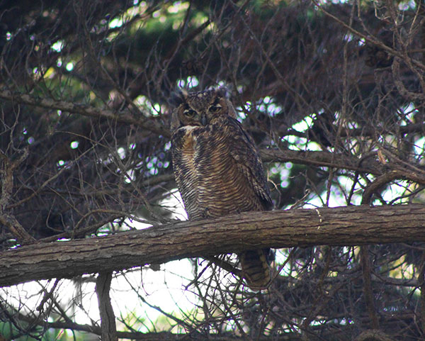
Great Horned Owl using a Monterey Cypress grove, September 2019 (Cédric Duhalde)
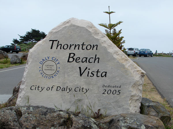
Entry sign, Thornton Beach Vista, May 2009 (Jennifer Rycenga)
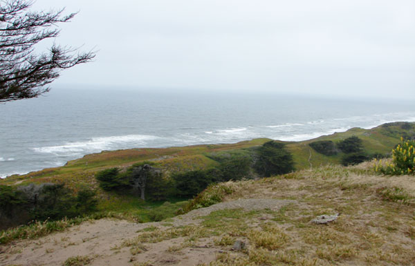
Looking north along coastal scrub, Thornton State Beach, Daly City Vista, May 2009 (Jennifer Rycenga)
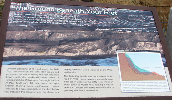
The text from the storyboard on the area's geology, May 2009 (Jennifer Rycenga, photo)
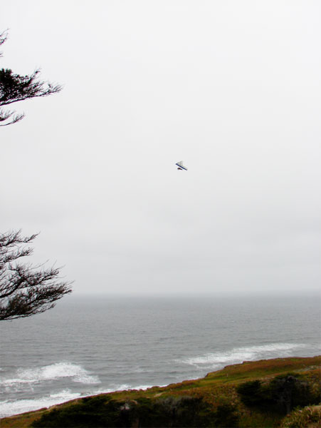
Hang-gliders have the best views of what used to be Thornton State Beach, May 2009 (Jennifer Rycenga)
Author: Jennifer Rycenga
Uploaded:
May 24, 2009
Last Update:
December 1, 2020 6:25pm
All content ©Sequoia Audubon Society and others
No use without written permission
