 Summer
 Fall
Winter

Spring
Summer
Fall
Winter
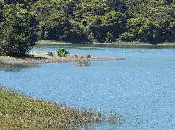
Crystal Springs Reservoir, looking west near the intersection of SR35 and SR92 by I-280, April 2011 (Jennifer Rycenga)
It is hard to imagine what the extent of the undeveloped lands of San Mateo County would be if there were no San Francisco Watershed. This vast acreage comprises some of the finest native and lightly altered habitat in San Mateo County. Lakes, wetlands, old growth and mature second-growth woodland, grasslands, oak savannah, coastal scrub – it is all present in ample portions. Access to this land is highly restricted, except for certain public corridors and limited docent-led or permit-only access. While some – particularly avid recreationalists and sportspeople – chafe at the limitations on access for fishing, hiking and biking, others appreciate the rare opportunity for pristine, native habitat the stringent protections have provided. Whatever one's position on the access spectrum, it is fair to say that without the San Francisco Watershed this marvelous area would more closely resemble the other over – built, native habitat-degraded areas of the County.
Leaving to others the complex puzzle of access vs. preservation, how might a San Mateo County birder approach this interesting landscape? The properties managed by the San Francisco Water Department comprise 23,000 acres stretching from Pacifica and Daly City in the north to Woodside in the south, from the Interstate 280 corridor west to private coastal holdings. Some of the lands abut public land managed by other agencies. The heart of the Watershed is a series of reservoirs built in the middle of the valley formed by the San Andreas Fault. North to south, these are San Andreas, Lower Crystal Springs and Upper Crystal Springs Lakes. A fourth lake, Pilarcitos Lake, is tucked away deep in the Watershed and visible only by permit or airplane.
The watershed lakes and the surrounding landscape are owned and maintained by the City and County of San Francisco for the purpose of maintaining a water supply for citizens of San Francisco and adjacent communities. In its early years, water was one of the greatest needs of the city. The lack of water was both dangerous (San Francisco burned to the ground six times because there was no water to put out fires) and expensive (costing as much as a dollar a bucketful).
In 1858 the Spring Valley Water Works was founded in San Francisco in an attempt to meet the growing water needs of the city. They hired a young German engineer, Herman Schussler, who built the San Andreas Dam in 1868. The Sawyer Camp trail crosses this dam. Ten years later; he constructed the Upper Crystal Springs Dam, now the Highway 92 causeway between Upper and Lower Crystal Springs Reservoirs. His greatest engineering feat, however; was the building of what was then the world's largest concrete dam, the Crystal Springs Dam across San Mateo Creek. It was completed in 1890 and visited by engineers from all over the world. It is located on Skyline Drive (Highway 35), just south of Crystal Springs Road. The dam withstood the 1906 earthquake, even though pipes that lay only a few hundred feet away were sheared off.
This valley lies along the infamous San Andreas fault, the area of fracture between two of the earth's major plates. The Pacific Plate is on the west and the American Plate on the east. As you walk along the Sawyer Camp Trail you parallel this fault zone, and you walk mostly on the American Plate.
Drivers zooming north or south on Interstate 280 might gaze at the sun setting over the beautiful Crystal Springs Lakes, or the mist rising over those same vistas on their morning commute, and wonder how one might get a better look. Fortunately there are some managed public access corridors that allow a close inspection of this great land, as well as a few public roads that cut through or adjoin the Watershed lands.
San Andreas Trail
The northernmost reservoir is San Andreas Lake. A public trail, unsurprisingly named the San Andreas Trail, extends along it from San Bruno Avenue south to Hillcrest Boulevard where it connects to the Sawyer Camp Trail. The first two miles is paved, but the southern .7 mile is gravel and not passable by bicycles which have to detour to the frontage road to get to the Sawyer Camp Trail [fact check - still true?]. As you walk down the trail from the north entrance, you can see in the west the point on Sweeney Ridge from which Gaspar de Portola first saw San Francisco Bay in 1769 (see entry on Sweeney Ridge - San Bruno Access, in this guide). You will have lovely views of San Andreas Lake and the wooded mountains beyond as you walk through groves of Monterey Pine and old cypress and open grassy areas. Unfortunately, most of the trail parallels Interstate 280 and the resulting traffic noise intrudes on birding by ear, and creates a distinctly urban atmosphere! The birds are similar to those listed below for the Sawyer Camp Trail, but pay particular attention to the transmission towers along the way for they are often used by raptors, which may include a rare Merlin and Peregrine Falcon, especially in the winter.Sawyer Camp Trail
This is a beautiful 6.5 mile paved multi-use trail extending from Hillcrest Boulevard south to Crystal Springs Road. It gets extremely heavy use, particularly on the weekends. Watch for bicyclists. The county has had to impose a bicycle speed limit – enforced by radar-gun wielding park staff who can and do issue speeding tickets – as there have been a number of injuries from collisions with walkers, runners and other bicycles! This land was owned by Leander Sawyer around 1853 and the trail was the access to his camp. Later it was used by the stage coach to Half Moon Bay. The trail is generally downhill going south, particularly in the first mile or so until you reach San Andreas Dam.In winter be sure to scan the reservoir from the overlook 100 yards north of the dam. Such county rarities as Wood Duck, Hooded and Common Mergansers and Osprey have been spotted from here. On at least one occasion, a Red-necked Grebe was found. Gulls like to sit on the string of floats just north of the dam, allowing a close study. A scope helps to scan the far western banks and coves, where the rarer waterfowl often hide.
The area from the dam to the north end of Lower Crystal Springs Reservoir is the most productive for birds. Since this is the point of the trail furthest from the northern and southern trailheads the area gets less human use. Moist woods (willow, live oak, bay and buckeye) along the stream are alive with singing birds and wildflowers from March through July. Look for California Quail, Band-tailed Pigeon, Downy, Hairy and Acorn Woodpeckers, California Thrasher, Brown Creeper, Pacific and Bewick's Wrens, Hutton's Vireo and Purple Finch year-round. Allen's Hummingbird, Pacific-slope Flycatcher, Western Wood-Pewee, Warbling Vireos, Wilson's and Orange-crowned Warblers and Black-headed Grosbeak are common in summer. Hermit Thrush, Golden-crowned Sparrow and Yellow-rumped Warbler are winter visitors, with Varied Thrush also present, but harder to find as it lurks in the Madrones and oaks. Red-shouldered and Cooper's Hawks nest in the area.
The northern end of Lower Crystal Springs Reservoir can be good for ducks (including an occasional Wood Duck) if enough marshy edge is exposed. Green Heron is an uncommon migrant. Check any swallows carefully since all North American species (with the exception of Cave Swallow) are possible. Purple Martin is of rare but regular occurrence. A pair of them was once found nesting at Pilarcitos Lake inside the watershed boundary. Check the Monterey Pines for Pygmy Nuthatch (resident) and Red-breasted Nuthatch (winter, in invasion years).
Open areas (grassy, oak and scrub) anywhere east of the reservoirs should be checked for raptors. Both species of eagles are rare but regular; White-tailed Kite is an uncommon resident and Peregrine Falcon and Merlin are rare from fall through spring. More common residents are California Thrasher, Western Meadowlark, Pine Siskin, and American and Lesser Goldfinches. In winter, look for Townsend's and Yellow-rumped Warblers, Fox Sparrow, Varied and Hermit Thrushes.
About half way down Sawyer Camp Trail, just north of Lower Crystal Springs Reservoir, is the famous Jepson Laurel. This 600-year old laurel is the oldest and largest laurel (California Bay) in California. It was named in honor of Willis Linn Jepson, one of California's most noted botanists.
Sawyer Camp Trail ends (or begins, if you walk from south to north) at Crystal Springs Road where you either have to retrace your steps or have a car waiting. You can then head south on Skyline and almost immediately cross Crystal Springs Dam. The dam and pullouts further south on Skyline should be used to scope Lower Crystal Springs Reservoir. In about 1-1/2 miles, at a stoplight, turn left and then, very shortly, take your first right onto Cañada Road.
Cañada Road Vantage Points.
Use the pullouts on Cañada Road to scope Upper Crystal Springs Reservoir and observe woodland and open grassland species. In winter the open deep water of both these reservoirs can be good for Common Loon, Horned Grebe, Double-crested Cormorant, Common Goldeneye, and Bufflehead. Less common, but occurring every year from fall through spring, are Common and Hooded Mergansers. At all seasons gulls bathe on the reservoirs in high numbers, and in winter you frequently can sight Herring, Thayer's, Mew and Bonaparte's Gulls, in addition to the expected species of Western, Glaucous-winged, and California Gulls. Check the shoreline for Great Blue Heron, Great Egret, Spotted Sandpiper (all year), American Pipit, Wilson's Snipe, Greater Yellowlegs and Belted Kingfisher (fall through spring). Canada Goose occurs year round with a few pair nesting. Osprey is seen regularly during migration and occasionally in winter. Check all snags for Bald Eagle since one is present in most winters. There is varied habitat in the area and in the springtime this is a good place to find a variety of species such as Black Phoebe, Warbling Vireo, Purple Finch and Swainson's Thrush (this last species is more often heard than seen in the surrounding thickets). The Highway 92/Interstate 280 interchange usually hosts nesting White-throated Swift; migrant Vaux's Swifts can sometimes be found among them in spring and fall. The best (and safest) vantage point is from the wide pullouts where Cañada Road intersects Highway 92, just south of the stoplight.Depending on water levels, dabbling ducks may be present in good numbers at the marshy south tip of the Upper Reservoir from fall through early winter. Look for Gadwall, Green-winged Teal, Cinnamon Teal, Wood Duck, Northern Pintail, Northern Shoveler, American Wigeon, Canvasback, Ring-necked Duck, both Scaup species and Ruddy Duck. Rare, but to be looked for, are Eurasian Wigeon, Redhead, Barrow's Goldeneye, Tundra Swan, Snow Goose and Greater White-fronted Goose.
Continuing south on Canada Road from the southern tip of the Upper Reservoir (the Pulgas Water Temple area) to Edgewood Road can be very productive but parking is limited. Residents in this area include Western Bluebird (uncommon), White-breasted Nuthatch, Western Screech-Owl, Barn Owl, Acorn and Nuttall's Woodpeckers. A few Say's Phoebe can be found here in most winters. Listen for the scratchy-melodious song of California Thrasher from the patches of scrub along the road. Wild Turkey was introduced by the California Department of Fish and Game in the 1980's and a few are seen occasionally in the oaks, but are more reliable at the Filoli Estate lawn. Western Kingbird uses the area in spring migration.
Cañada Road is a favorite among bicyclists; bicycling is a good way to see the area. The county of San Mateo used to sponsor bicycle Sundays along the road by closing it to vehicular traffic; as of this writing, those days have been suspended. Good destinations for the bike trip is the Pulgas Water Temple or the adjacent Filoli Estate, but the somewhat mystifying open hours at the Water Temple can be difficult to discern. Read the chapter in this guide about Filoli for the excellent birding opportunities available there.
Fifield-Cahill Ridge Trail.
A new and exciting opportunity for access to the Watershed was provided with the opening of a multi-use trail along Cahill and Fifield Ridges deep in the Watershed lands, stretching from the old Skyline Quarry Gate on Highway 92 to the Portola Gate on Sweeney Ridge. Access to this trail requires pre-registration and an accompanying docent. Reservation details are available, and a pdf map of the trail and entry points.Precisely how birding-oriented your experience might be will depend on the docent and the other participants. Some trips have a more distinctly recreational character, while others emphasize the wildlife. The trail is actually a well maintained gravel service road, approximately ten miles long, with some steep segments, but generally a pleasant grade, and moves through a variety of terrain. Wildlife viewing possibilities along the road are outstanding.
The trail begins at the old Skyline Quarry. Whether any time will be allowed to bird in that vicinity depends upon the particular docent and interests of the entire group. If time does allow it, look for the pond at the bottom of the quarry, just to the left of the interpretive sign and inner parking area (all inside the Quarry Gate). The thick reeds host Virginia Rail and (less commonly) Sora, as well as a good array of wetland breeding birds and wintering sparrows including Lincoln's and (rarely) Swamp Sparrows. Will someone find a Black Rail there someday? Who knows?
Passing through an inner gate, the road turns heads steeply up Cahill Ridge. Some relatively quiet introduced cypress forests give way in places to tangles of moist understory, where Pacific Wren, Swainson's Thrush, Song Sparrow and other skulkers call. As the road ascends Cahill Ridge, the habitat changes to mature second growth Douglas Fir and eventually old growth Douglas Fir, with a rich understory of oak, California Bay, Poison Oak and wild blackberry. Acorn, Hairy and Nuttall 's Woodpeckers and Northern Flicker are common. Red-breasted Sapsucker is present, but harder to pin down. Watershed staff has reported the recent arrival of Pileated Woodpecker, which still counts as a rarity this far north on the Peninsula. In winter large mixed insectivore flocks move through the canopy, sometimes coming low enough for a good look, but other times requiring the patient birder to suffer some neck strain while trying to get a glimpse. Ruby-crowned Kinglet, Chestnut-backed Chickadee and Townsend's Warbler make up the main part of these flocks, but careful study will often reveal a jewel of a Hermit Warbler in their midst. There is plenty of opportunity for practice in distinguishing the thin, high warble of Golden-crowned Kinglet from Brown Creeper. Flocks of Pine Siskin might pass through, or, less commonly, Red Crossbill. In the spring and summer months the flocks break up and most of the above might be found in pairs or family groups.
The trail passes Five Points road junction and breaks into open country on Fiefield Ridge. Here the birdlife consists of the expected coastal scrub species, but with good chances for raptors overhead. Even the most ardent of birders should find the spectacular vistas of the entire Bay Area inspiring and worthy of a second or third look. The trail ends at the Portola Gate, where further public access continues along Sweeney Ridge.
Deeper Into the Refuge.
Opportunities to explore deeper into the refuge exist, but are even more restricted. Typically they require participation in Sequoia Audubon's Crystal Springs Christmas Bird Count, or some other ornithological study or survey. Occasionally an outside organization runs field trips into these less commonly visited areas. Your best bet is to check with Sequoia Audubon to see if any volunteer opportunities exist or whether any field trips are planned.If you are able to gain access, the San Mateo Creek and Pilarcitos Creek headwaters provide great scenic beauty and yet more excellent birding opportunities. A colony of Marbled Murrelet is under current study by biologists, but you would have to be very lucky to see these birds in the Watershed. Rarities in these areas have included American Dipper and Northern Waterthrush. The San Mateo County Breeding Bird Atlas project confirmed nesting Hermit Warbler on Scarper Peak and Purple Martin near Pilarcitos Dam. The steep old-growth Douglas Fir-covered slopes to the west of Pilarcitos Creek and the densely forested mixed coniferous-hardwood forests that abut Skyline Boulevard are unknown territory, bird-wise.
Canada Goose, Wood Duck, Gadwall, American Wigeon, Mallard, Northern Shoveler, Northern Pintail, Cinnamon Teal, Green-winged Teal, Canvasback, Ring-necked Duck, Greater Scaup, Lesser Scaup, Bufflehead, Common Goldeneye, Ruddy Duck, Common Merganser, Hooded Merganser, California Quail, Common Loon, Pied-billed Grebe, Horned Grebe, Eared Grebe, Western Grebe, Clark's Grebe, Double-crested Cormorant, Great Blue Heron, Great Egret, Snowy Egret, Green Heron, Turkey Vulture, Osprey, White-tailed Kite, Northern Harrier, Cooper's Hawk, Red-shouldered Hawk, Red-tailed Hawk, American Kestrel, Merlin (uncommon, winter and migration), Peregrine Falcon, American Coot, Killdeer, Spotted Sandpiper, Greater Yellowlegs, Ring-billed Gull, Western Gull, California Gull, Herring Gull, Caspian Tern, Forster's Tern, Band-tailed Pigeon, Mourning Dove, Barn Owl, Great Horned Owl, White-throated Swift, Vaux's Swift, Anna's Hummingbird, Allen's Hummingbird, Belted Kingfisher, Acorn Woodpecker, Red-breasted Sapsucker, Nuttall's Woodpecker, Downy Woodpecker, Hairy Woodpecker, Northern Flicker, Olive-sided Flycatcher (migration), Western Wood-Pewee, Pacific-slope Flycatcher, Black Phoebe, Say's Phoebe, Hutton's Vireo, Warbling Vireo, Steller's Jay, Western Scrub-Jay, American Crow, Common Raven, Northern Rough-winged Swallow, Violet-green Swallow, Barn Swallow, Cliff Swallow, Tree Swallow, Chestnut-backed Chickadee, Oak Titmouse, Bushtit, Red-breasted Nuthatch, White-breasted Nuthatch, Pygmy Nuthatch, Brown Creeper, Bewick's Wren, Marsh Wren, Pacific Wren, Golden-crowned Kinglet, Ruby-crowned Kinglet, Wrentit, Western Bluebird, Hermit Thrush, Swainson's Thrush, Varied Thrush, American Robin, California Thrasher, European Starling, Orange-crowned Warbler, Yellow-rumped Warbler, Townsend's Warbler, Hermit Warbler (uncommon), Wilson's Warbler, Common Yellowthroat, Spotted Towhee, California Towhee, Chipping Sparrow (uncommon), Fox Sparrow, Lincoln's Sparrow, Song Sparrow, White-crowned Sparrow, Golden-crowned Sparrow, Dark-eyed Junco, Black-headed Grosbeak, Lazuli Bunting (unusual at this location), Red-winged Blackbird, Western Meadowlark, House Finch, Purple Finch, Pine Siskin, American Goldfinch, Lesser Goldfinch
In this guide, "rarities" are defined as those species given an County Abundance Code of 4, 5, or 6.
Greater White-fronted Goose, Snow Goose, Tundra Swan (2003), Eurasian Wigeon, Redhead (2020), Barrow's Goldeneye, Red-necked Grebe (2009, 2012, 2014, 2015), Wild Turkey, Bald Eagle (annual here; failed nesting attempt in 2012 first nesting record in San Mateo county since 1915), Rough-legged Hawk, Sora (quarry), Virginia Rail (quarry), Red-necked Phalarope (rare inland), Slaty-backed Gull (2014), Thayer's Gull, Mew Gull (rare here), Bonaparte's Gull (rare here), Lesser Black-backed Gull (2016), Glaucous Gull (2014), Marbled Murrelet, Western Screech-Owl, Black Swift (rare, migration, 2012), Williamson's Sapsucker (2013), Western Kingbird (migration), Eastern Kingbird (2021), Cassin's Vireo, Pileated Woodpecker (increasing in numbers), Purple Martin (has nested), Bank Swallow, American Dipper, Townsend's Solitaire (2012), Northern Waterthrush, Northern Parula (2007), Black-and-White Warbler (2004), Swamp Sparrow, White-throated Sparrow (2007), Evening Grosbeak (2013)
Access from Interstate 280, traveling north to south
North entrance to San Andreas Trail. When traveling south on I-280 take the Sneath Lane-San Bruno Avenue Exit. Go straight to San Bruno Avenue and turn right (west). When it dead ends turn left (south) on Skyline Boulevard (Highway 35). In about .6 mile you will see some pullouts and a parking area on the west side of the highway.
South entrance to San Andreas Trail and North entrance to the Sawyer Camp Trail. From the San Andreas Trail parking area, continue south on Skyline until it merges with I-280 South. From here on for the next several miles, Skyline Boulevard either shares 1-280 or parallels it and may be called Skyline Boulevard, Skyline Drive or Skyline Highway, depending on local usage. Take the first exit (Hillcrest, also marked Larkspur & Millbrae). Pass back under the freeway and turn right (south) on the frontage road (Skyline). Follow it to Hillcrest, turn right and park at the end. The San Andreas Trail leads off to the right (north), and the Sawyer Camp Trail to the left (south)
South end of the Sawyer Camp Trail. From the North entrance parking area, return to I-280 South and take the Black Mountain Road/Hayne Road exit. Turn right (west) and then, in a very short distance, left (south, on Skyline again). In about 1.3 miles you come to the Crystal Springs Road intersection and the south entrance to the Sawyer Camp Trail. Continuing south on Skyline, you come almost immediately to the Crystal Springs Dam, which also has parking.
Cañada Road. Continue south on Skyline, using the pullouts to scope Lower Crystal Springs Reservoir. At the stoplight (a little over a mile past the dam), you turn left (east) and follow the signs that lead you onto Canada Road. Continue on Canada Road which parallels the east side of Upper Crystal Springs Reservoir; again using the pullouts to scope the reservoir. Exit Cañada Road at Edgewood Road, with further access back to Interstate 280.
Access from Interstate 280, traveling south to north.
South end of Sawyer Camp Trail. THIS ENTRANCE CLOSED THROUGH AT LEAST 2014. Go to the website for the Crystal Springs/Sawyer Camp Trail for updated information.
When traveling north on I-280, take the Highway 92/Half Moon Bay exit, at the stoplight turn right (north) on Skyline (SR 35). In about 1.3 miles you reach the Crystal Springs Road intersection and the south entrance to the Sawyer Camp Trail. Return to I-280 North either at Crystal Springs Road or at Black Mountain/Hayne Road (about 1.3 miles further on Skyline).North entrance of the Sawyer Camp Trail and South entrance of San Andreas Trail. Heading north on I-280, take the Millbrae (Larkspur, Hillcrest) exit. Go straight (Skyline) and take the first left under the freeway (Hillcrest). The trail entrance is at its end. The San Andreas Trail is on the right.
North entrance of San Andreas Trail. Exit I-280 North at the State Highway 35/Skyline Boulevard Exit. Continue north for about .7 miles, looking for the parking pullouts on both sides of the road. The San Andreas Trail goes to the south from here, and for a short distance to the north as well.
Cahill-Fiefield Ridge Trail. Parking access is inside the Skyline Quarry Gate off State Highway 92. Follow instructions provided by the San Francisco Watershed at the time you make your reservation.
Red Markers: Parking Area or Trail Head
Hover mouse pointer over marker, or click marker, for pin identification.
Use + or - buttons to change map zoom. Click & Drag to pan.
There are no fees for using any open, public area in the watershed.
The Sawyer Camp and San Andreas trails are open from sunrise to sunset. It is very important that you observe this rule. Due to the obvious security concerns about a major reservoir in an urban area, you will be arrested - and prosecuted - if found within the watershed after dark.
Cañada Road is open 24/7, of course; driving along this road slowly at night is good for Great Horned and Barn Owls. Driving slowly is also good because there are a lot of deer in this area; this also raises the possibility of seeing Mountain Lions. DRIVE SLOW: it will benefit you, your car, and the long life of the animals we love to see.
For such a safe place, there are lots of small irritants to keep in mind in the watershed area: poison oak, rattlesnakes, mountain lions, ticks, and stinging nettles. Along the roads that border the watershed, and the multi-use trails, you need to be especially cautious about bicycle traffic. Do not go where entry is prohibited. Not only will you be arrested and prosecuted, but you will jeopardize continued controlled access for others. Birders have been banned from a number of sensitive sites around the state because of misbehavior. Don't let this be your local claim to fame!
There are no restrooms on the San Andreas Lake Trail but several on the Sawyer Camp Trail. Gas stations are located nearby at the crests of Hillcrest Boulevard and Millbrae Avenue. Stores for victuals and supplies can be found most easily east of I-280.
Accessibility information is currently not available for this location.
The park phone number is listed as (650) 589-4294. Website
There are currently three major eBird hotspots that relate to this wide area. A pair can be found under "Sawyer Camp Trail-north" and "Sawyer Camp Trail-south" and the other, more general, is called "Crystal Springs Reservoir." Because access to this area is so irregular and rare, it is probably best to keep these three hotspots, despite their admitted level of generality. There is a separate hotspot for Filoli, confusingly named "Filoli/SF Watershed," but since its map location clearly shows it below the south end of the reservoir, one hopes that new users will default to the "Crystal Springs Reservoir" for their entries. Between the hotspots, ninety-six species have been recorded, with data in 33 of 48 time quadrants. Summer data is particularly lacking: let's fill it in!
The iNaturalist place marker for the Watershed has a substantial amount of data in its wide geographic coverage area.
The watershed has long been a favorite field trip destination for Sequoia Audubon Society, with over 43 scheduled visits over the entire history of the chapter. Many of these were along the Sawyer Camp Trail.
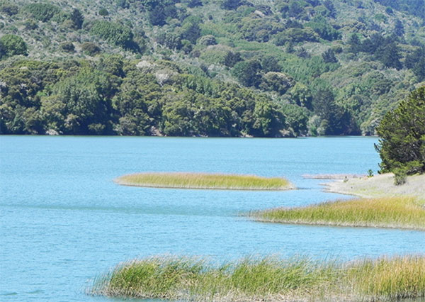
Crystal Springs Reservoir, looking north near the intersection of SR35 and SR92 by I-280, April 2011 (Jennifer Rycenga)
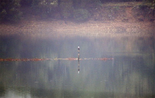
Bald Eagle, Upper Crystal Springs Reservoir, December 2009 (Sonny Mencher)
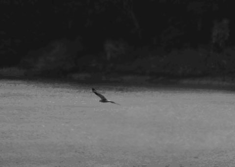
Rough-legged Hawk, Upper Crystal Springs Reservoir, January 2008 (George Chrisman)
Author: Jennifer Rycenga
Uploaded:
April 22, 2011
Last Update:
January 11, 2022 12:21pm
All content ©Sequoia Audubon Society and others
No use without written permission
