 Summer
 Fall
Winter
Spring
Summer
Fall
Winter
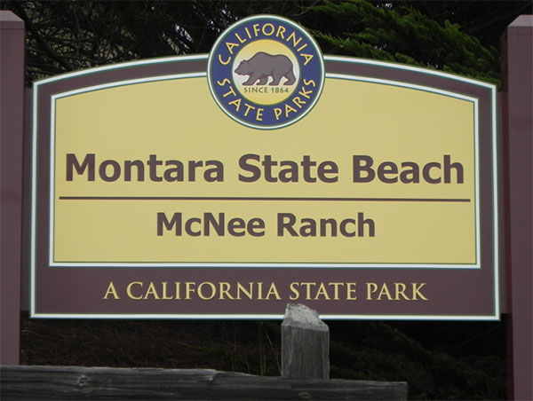
Sign at Martini Creek parking area for McNee Ranch. August 2011 (Jennifer Rycenga)
Montara State Beach is the area just south of Devil's Slide along SR 1. There is a large sandy beach that is one of the few coastal beaches still open to dog-walking, which holds down the number of shorebirds that can be seen here. There is a formal parking lot, and a few other pull-offs on the west side of SR1 for beach access.
Montara State Beach also includes a substantial portion of Montara Mountain in its jurisdiction, referred to as McNee Ranch. The access to McNee Ranch is located on the east side of SR1. This extensive mountain park is a much more promising bird location than Montara Beach proper.
Along SR1 south of Devil's Slide (and south of where the planned tunnel will deposit drivers back onto the existing roadway), there is a small park unit, called Gray Whale Cove State Park. This area is not particularly good for birding, for two reasons. One is that it is an isolated cove, with species limited to a few breeders and seabirds. The second reason is that the beach is heavily used by recreational beach-combers, including some who feel this is a clothing-optional area. Anytime we birders, with our high-powered binoculars, trip into an area where nude sun-bathers are present, we are likely to be mistaken for voyeurs, plain and simple.
This article will focus on the McNee Ranch division of Montara Beach State Park, as it holds the most birding interest. Furthermore, it is possible to scope the open beach sections of both Montara Beach proper and Gray Whale Cove Beach, from the cliff tops of McNee Ranch, enabling you to glimpse any birds daring to use those beaches. The high cliffs of McNee Ranch's Gray Whale Cove Trail create a fine platform for sea-watching, as well.
McNee Ranch constitutes the state park portion of Montara Mountain. An unusual mountain, Montara spans from the center of the county right to the ocean. In the words of one website (http://plants.montara.com/mmoverview.html), Montara Mountain "is an ecological island of natural biological diversity. Its steep slopes have minimized human impact, and it is home to plant and animal communities found no where else in the world." Any birders who also have an interest in botany will love this park.
There are two parking areas for accessing the McNee Ranch trails. The Gray Whale Cove lot on the north end, along Route 1, gives one access to the Gray Whale Cove Trail. The small lot (room for only three-four cars) at Martini Creek (on the east side of SR1, at the base of the ascent up Devil's Slide) on the south gives one many more choices for trails and adventures. The easiest and most scenic decision is to take the northbound Gray Whale Cove Trail. After a brief ascent, this trail takes you to the cliffs overlooking SR1 and the ocean. There are some well-placed benches for enjoying the view. Most of the habitat consists of chaparral, home to birds like Wrentit, California Scrub-Jay, and Spotted Towhee. In addition, there are raptors overhead, and, out to sea, gulls, Brown Pelicans, and whatever your sea-watching eyes can pick out with a scope. Sooty Shearwaters in fall are fairly easy to pick out, and Common Murre (usually fathers giving lessons on proper murre protocol to their chicks: do not be fooled into thinking you are seeing Murrelets!) can be observed as well. Brandt's and Pelagic Cormorants roost on the coastal rocks, along with Black Oystercatchers, and, in fall, Wandering Tattlers. The double benches about half-way along the trail, and the first full ascent to the cliffs, afford the best sea-watching perches. There are connections from the Gray Whale Cove Trail to the Old Pedro Mountain Road.
The other trail choice from the Martini Creek parking area is to walk the entrance road. Walking up this road locates you in a riparian zone along the creek. In less than 1/2 mile you come to a ranger's residence. To the north there is an old quarry cut, with picnic tables and a port-a-potty. You have views of the ocean from here. You can continue along the road, which, while a steep hike, is also a rewarding one for the views and the habitats. The chaparral here includes many small ravines, so birds can often seem to pop out from hiding. Raptors are often visible soaring somewhere in the expansive sky.
The summit is often fog-shrouded, especially in summer, and later in the day in other seasons. Still, there are good finds to be made here, as this is close to 1900 feet in elevation. An intriguing feature of this park is the opportunity afforded for long hikes between McNee Ranch State Park and San Pedro Valley County Park. If you have two cars, and therefore can make this a one-way trek, you will be able to enjoy the relatively pristine beauty of Montara Mountain for an entire day (about 5 miles one way). Just beware, especially in summer, of the thick fog that can roll in during the mid-to-late afternoon.
The current construction of a tunnel to avoid the problems of road closure due to frequent landslides along SR 1 at Devil's Slide, is slated for completion in late 2012. The construction equipment and noise currently does not detract very much from one's experience at the park, and, once the tunnel is complete, it will make travel in this area more certain and secure. However, especially along the Gray Whale Cove Trail, traffic noise can impinge on your enjoyment. Often the ocean waves, though, will drown out the highway sounds.
Not many parks in this guide have an entire book written about them. Barbara VanderWerf's Montara Mountain (Gum Tree Lane Books, 1994) is an indispensable guide to the plants and the history of the mountain. This is one of my favorite books on local history and culture: get a copy if you can. The book is now out-of-print, but there are used copies available via your favorite internet sources.
Surf Scoter, California Quail, Pacific Loon, Western Grebe, Clark's Grebe, Sooty Shearwater (fall), Brandt's Cormorant, Pelagic Cormorant, Double-crested Cormorant, Brown Pelican, Turkey Vulture, Osprey (fly-over, rare), Northern Harrier (uncommon at this location), White-tailed Kite, Sharp-shinned Hawk, Cooper's Hawk, Red-shouldered Hawk, Red-tailed Hawk, Black Oystercatcher, Killdeer, Whimbrel, Wandering Tattler, Surfbird, Willet, Heermann's Gull, Western Gull, Glaucous-winged Gull, California Gull, Elegant Tern, Caspian Tern, Common Murre, Pigeon Guillemot, Rock Pigeon, Band-tailed Pigeon, Eurasian Collared-Dove, Mourning Dove, White-throated Swift, Black Swift (migration), Anna's Hummingbird, Allen's Hummingbird, Great Horned Owl, Belted Kingfisher, Hairy Woodpecker, Downy Woodpecker, Nuttall's Woodpecker (uncommon at this location), Northern Flicker, Olive-sided Flycatcher (migration), Pacific-slope Flycatcher, Black Phoebe, Say's Phoebe, American Kestrel, Peregrine Falcon, Steller's Jay, California Scrub-Jay, American Crow, Common Raven, Northern Rough-winged Swallow, Violet-green Swallow, Tree Swallow, Cliff Swallow, Barn Swallow, Blue-gray Gnatcatcher, Chestnut-backed Chickadee, Bushtit, Red-breasted Nuthatch, Pygmy Nuthatch, Brown Creeper, Bewick's Wren, House Wren, Pacific Wren, Wrentit, Golden-crowned Kinglet, Ruby-crowned Kinglet, California Thrasher, Swainson's Thrush, Hermit Thrush, American Robin, European Starling, Orange-crowned Warbler, Common Yellowthroat, Townsend's Warbler, Yellow-rumped Warbler, Wilson's Warbler, Spotted Towhee, California Towhee, Fox Sparrow, Song Sparrow, White-crowned Sparrow, Golden-crowned Sparrow, Dark-eyed Junco, Lincoln's Sparrow, Savannah Sparrow, Western Tanager, Black-headed Grosbeak, Red-winged Blackbird, Brewer's Blackbird, Purple Finch, House Finch, American Goldfinch, Lesser Goldfinch, Pine Siskin, Red Crossbill (unexpected irruptive)
In this guide, "rarities" are defined as those species given an County Abundance Code of 4, 5, or 6.
Red-footed Booby (Pt. San Pedro, 1982), Osprey, Rough-legged Hawk (1997), Swainson's Hawk (2019), Common Poorwill (2021), Dusky Flycatcher (2009), Purple Martin (2022), American Redstart (2010), Dusky Flycatcher (2009), Rock Wren (2020), Mountain Bluebird (2019, near the North Peak summit on the North Peak Access Road/Trail), Bell's Sparrow (2018, 2020, 2021, 2022 near the North Peak summit on the North Peak Access Road/Trail)
All three of these divisions (Montara Beach, Gray Whale Cove, and McNee Ranch State Parks) are located on SR1, eight miles north of Half Moon Bay and contiguous to the northern boundary of Montara. These areas are just south of Devil's Slide on SR1.
Red Markers: Parking Area or Trail Head
Hover mouse pointer over marker, or click marker, for pin identification.
Use + or - buttons to change map zoom. Click & Drag to pan.
There are no fees to use these State Parks.
Day use areas are officially open from 8:00 am to sunset.
Ticks, rattlesnakes, and mountain lions are all possible, but not as intensively as at other parks. Don't eat wild mushrooms up here, as some of them could constitute your last meal. Other concerns are, quite literally, more pedestrian than matters of life and death. All areas of the park are used by dogs and their walkers. Horses use many of the trails at McNee. Mountain bikers like to use the cliffs of McNee. Poison Oak is rampant. So watch out for fast-moving bikes, horse poop, and the ever-present issue of off-leash dogs (park regulations decree that dogs are supposed to be leashed). Also, beware that car break-ins are frequent along the coastline; thieves, assuming that most parked cars belong to surfers, move with confidence that their intended victims are far away.
There are port-a-potties at the main parking lot for Montara State Beach, and one at the picnic area in McNee Ranch. Supplies of food and other necessary accouterments can be picked up at the small markets in Montara, or in Pacifica or Half Moon Bay, depending on your origin.
Accessibility information is currently not available for this location.
The telephone contact number is 650-726-8819.
McNee Ranch State Park is a hotspot in eBird. However, it is seriously under-populated with data. Please enter more sightings here. The importance of this area in terms of plant ecology makes it incumbent on us birdwatchers to monitor for changes in the avian population, and the coming of the tunnel and changes in auto patterns are also worth noting over time.
There is a Common Murre Restoration Project located off of Devil's Slide Point.
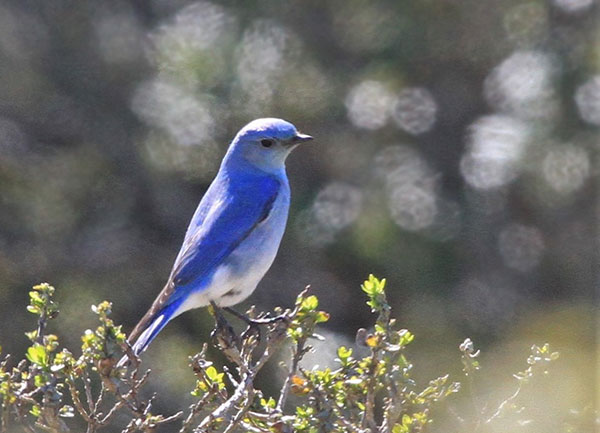
Gorgeous male Mountain Bluebird atop Montara Mountain, discovered by Dom Mosur, March 2019 (Kent Forward)
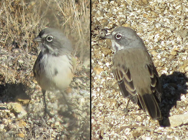
Apparently breeding Bell's Sparrow, discovered by Dominik Mosur in summer 2018, at the border of San Pedro Valley County Park, McNee Ranch State Park, and Rancho Corral di Tierra of GGNRA, on Montara Mountain (Kent Forward, August 2018)
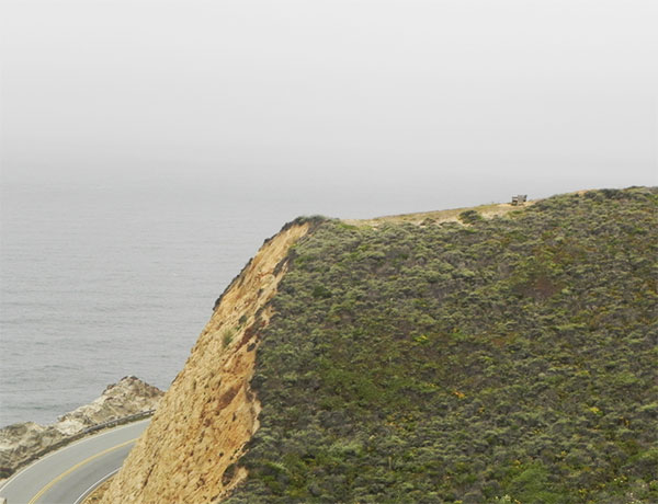
Dramatic cliff overlooking the ocean and SR1, along the Gray Whale Cove Trail at McNee Ranch State Park. Note the double benches perched on the bare area, away from the cliff's edge. Nice sea-watching spot. August 2011 (Jennifer Rycenga)
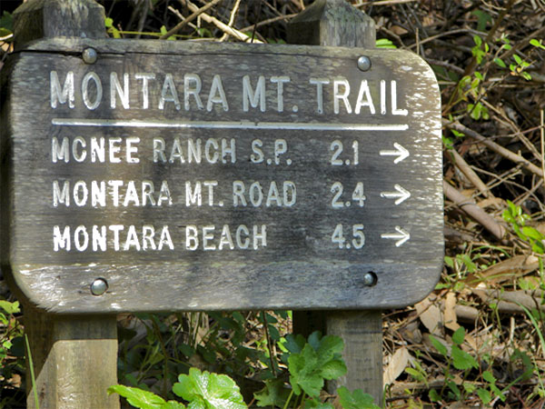
Trail sign in San Pedro Valley Park, near the western beginning of the Old Trout Farm Trail, showing the distances to the boundary with McNee Ranch State Park, and all the way to the shoreline. (Jennifer Rycenga)
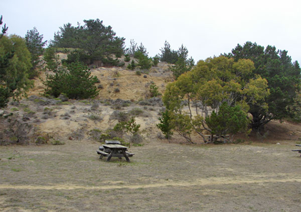
The picnic area just north of the ranger's residence has an interesting mix of vegetation and habitats, September 2009 (Jennifer Rycenga)
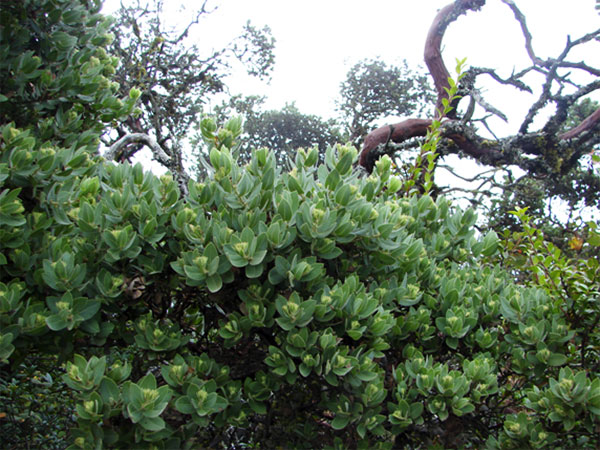
Vegetation at high elevation, McNee Ranch State Park, September 2009 (Jennifer Rycenga)
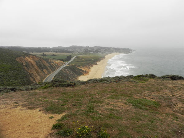
Montara State Beach, seen from the cliffs of the Gray Whale Cove Trail at McNee Ranch. This view is taken looking south. The agricultural field east of Highway 1 and below the mountain is part of the Peninsula Open Space Trust's Rancho Corral de Tierra, slated to become part of the Golden Gate National Recreation Area (GGNRA). August 2011 (Jennifer Rycenga)
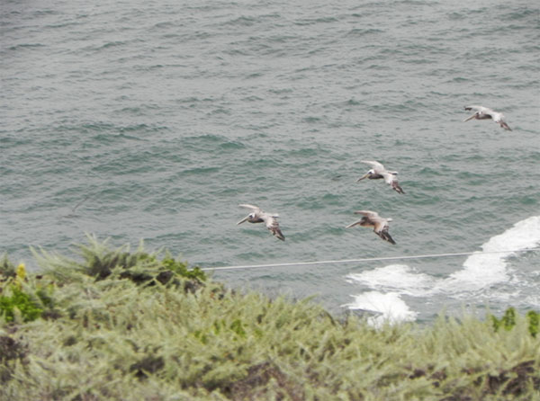
Long skeins of Brown Pelicans are a common sight along the coastline. This picture taken from the Gray Whale Cove Trail at McNee Ranch State Park. August 2011 (Jennifer Rycenga)
Author: Jennifer Rycenga with massive assistance from Nelle Lyons
Uploaded:
August 12, 2011
Last Update:
May 26, 2022 7:23am
All content ©Sequoia Audubon Society and others
No use without written permission
