 Summer
 Fall
Winter

Spring
Summer
Fall
Winter
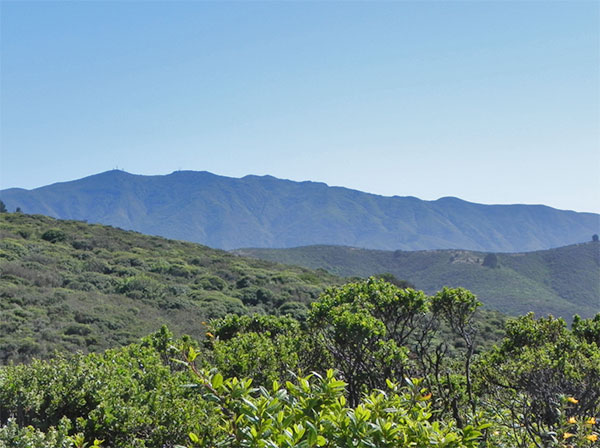
Looking south to Montara Mountain (background) and Baquiano Trail (foreground), from Mori Point Trail, Sweeney Ridge Pacifica Side, August 2011 (Jennifer Rycenga)
The Sweeney Ridge unit of the Golden Gate National Recreation Area (GGNRA) offers access from both coastal and bay communities - in this case, Pacifica and San Bruno. This birding guide offers separate entries for these two access points, but the trail systems are entirely interconnected, and therefore it is possible to walk from the beach to I-280. This guide decided to maintain two entries because the access points are so disjunct from each other, but the birding expectations are essentially identical.
Sweeney Ridge lies at the northern end of the San Francisco watershed area between San Bruno and Pacifica. These 1047 acres comprise one eighth of the landmass of the city of Pacifica. Sweeney Ridge became part of the Golden Gate National Recreation Area in February 1984.
There are a number of trails leading through the area; however, the Fassler Avenue entrance trail appears to be the trail of choice for many from Pacifica, especially history buffs who wish to follow in the footsteps of the Spanish explorers. One advantage of the Pacifica access point lies in its being closer to the Portola Discovery Site.
From Highway One take Fassler Avenue east to its end at a cyclone fence. Park on the street if possible and enter the area through the footpath through the fence. The first three-quarters mile of this trail, known as the Baquiano trail, rises steeply and can be considered a moderate to strenuous climb, depending on your physical condition. Immediately after the trailhead, you will see a water tank on your left. It is surrounded by evergreens and may have flocks of birds, especially during spring and fall migrations. Continue past the water tank, staying to the right at the fork in the road. Stop every now and then to check the skies for Red-tailed Hawk, Turkey Vulture, Sharp-shinned Hawk, Cooper's Hawk, and American Kestrel. Keep your eyes to the skies, as other hawks may be seen along this coastal corridor, particularly in the fall.
Upon reaching the top (around 1 mile), stop to rest and enjoy the beautiful views of the Pacific coast. Check on in, around and atop the Coyote Brush for Wrentit, White-crowned Sparrow, Fox Sparrow, Savannah Sparrow, Song Sparrow, California Towhee, and Spotted Towhee. At this point the toughest part of the trail is behind you. Wildflowers abound in April. Splashes of bright orange California Poppies, Checker-bloom, Blue-eyed Grass, Blue Dicks, mules ears, Footsteps of Spring, sun cups, buttercups, columbine, Indian paintbrushes, Cream Cups and goldfields dot the terrain. Many grasses also cover the coastal hills, along with Coyote Brush, Cow Parsnip, Ceanothus, Poison Oak, Wax Myrtle, soap plant, California Figwort, and various thistles.
From the top of the hill, continue in an eastward direction through a red metal fence. Listen for the familiar "bouncing ball" song of the Wrentit. Look for Mourning Dove, Brewer's Blackbird, Brown-headed Cowbird and the occasional Loggerhead Shrike. Western Meadowlarks dot the grasses and California Quail, Anna's Hummingbird, American Robin, Common Raven, American Crow and several species of swallows can be found here.
Stay to the left at the power lines, always proceeding on the main trail. Stop at the rock outcropping along the road to admire and examine the myriad small wildflowers, ferns, mosses, lichens, and succulents.
Continuing on, you will come to a two-way split in the road. Take the left fork, always staying on the main large trail. This will lead to the Portola Discovery Site and Skyline Ridge. When you reach the site, spend some time there. You will know the site by the monuments erected there to Gaspar de Portola's Expedition of 1769 and the Carl McCarthy Memorial Monument. Portola and his men made the first trip up Sweeney Ridge where they discovered San Francisco Bay 215 years ago. Carl McCarthy was one of those instrumental in founding the Portola Foundation and the driving force in the establishment of the Portola Discovery Site as a historical landmark. Enjoy the spectacular view. The Discovery Site is approximately one and a half miles from Fassler Avenue.
This trail you have just climbed is called the Baquiano trail, but unfortunately there are few signs until you are near the Portola Discovery Site. Trails and roads are not marked very clearly and when fog shrouds these coastal hills, it is very easy to lose one's bearings. Many trails and roads crisscross. Climbing on summer afternoons can be chancy as the fog can roll in very quickly and can be absolutely impenetrable. Strong winds are also typical of summer afternoons in the area and the combination can make the return very hazardous. More than one climber has had to be rescued by Pacifica's fire department. It is not a coincidence that Pacifica provides mountain and coastal rescue specialists for the entire county. However, once you are at the Portola Discovery Site, there are trail signs to lead you back to the San Bruno entrance on Sneath Lane, if you feel utterly lost and disoriented; there are mass transit options from that point.
During the spring, there are extensive areas of wild iris in bloom, with colors ranging from white through deep purple. There is a road south of the Discovery Site along the ridge. Watch for California Scrub-Jay and Northern Mockingbird along this road. Gulls and ducks fly overhead to and from the Spring Valley Lakes and inland waters. This road, the Sweeney Ridge Trail, follows the ridge approximately three quarters of a mile south to where one encounters the locked Portola Ridge Gate. The property beyond is owned by the San Francisco Water District and special permission must be obtained for extensive access to these lands. There is limited access near the gate. See the entry in this guide on San Francisco Watershed/Crystal Springs Reservoir for more information about access to these lands.
Backtracking to the Portola Discovery Site, look for deer and rabbits at sunset. This site is also the end point for the trail that originates on the eastern flank of Sweeney Ridge. From the Discovery Site, retrace your steps to the barbed wire barricade. From this point it is easy to take the wrong road; stay to the left at the fork. The entire hike is approximately five miles, and takes about four hours to walk, with stops for snacks, birds, and wildflowers. The Ridge may also be reached from the East. See the Sweeney Ridge-San Bruno Access entry for more details.
There is also a strenuous but rewarding trail that starts behind the Shelldance Orchid Nursery. This parking area is part of the Mori Point Trail, and gives access to the historic Coast Guard Post, and the entire network of trails on the San Bruno site. The Orchid Nursery is, itself, an historic site for horticulturalists. This trail has an elevation gain of about 450 feet in its first mile, but also has more varied habitat than much of the Ridge line, with alternating chaparral and conifer stands.
California Quail, Turkey Vulture, Sharp-shinned Hawk, Cooper's Hawk, Red-tailed Hawk, American Kestrel, American Coot, Western Gull, Anna's Hummingbird, Allen's Hummingbird, Mourning Dove, Great Horned Owl, Hairy Woodpecker, Downy Woodpecker, Northern Flicker, Loggerhead Shrike (rare at this location), Hutton's Vireo, Western Scrub-Jay, Common Raven, Violet-green Swallow, Barn Swallow, Chestnut-backed Chickadee, Pygmy Nuthatch, Bushtit, Bewick's Wren, Ruby-crowned Kinglet, American Robin, Hermit Thrush, Swainson's Thrush, Wrentit, Northern Mockingbird, California Thrasher, Orange-crowned Warbler, Common Yellowthroat, Wilson's Warbler, Spotted Towhee, California Towhee, Fox Sparrow, Song Sparrow, White-crowned Sparrow, Golden-crowned Sparrow, Dark-eyed Junco, Western Meadowlark, Brewer's Blackbird, Red-winged Blackbird, Brown-headed Cowbird, House Finch, Purple Finch, Red Crossbill, American Goldfinch, Lesser Goldfinch
In this guide, "rarities" are defined as those species given an County Abundance Code of 4, 5, or 6.
Common Poorwill (very rare, migration), Black Swift (migration, 2016), Western Kingbird (2016, 2017)
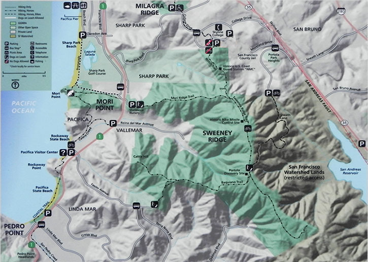
To reach the Fassler entrance, turn inland on Fassler from SR 1 and drive to its end (about 1.5 miles) and park on the street. The GGNRA discourages on-street parking; their map even announces, in red, that there is no trailhead parking here. They prefer that you park at the Rockaway Visitor's Center, and either walk or take mass transit to the Fassler trailhead.
A more auto-friendly location is by the Shelldance Orchid Nursery. Coming north of SR 1 past Reina del Mar street, take a right at the nursery signs. Do not fear if they say the nursery is closed: the trailhead parking lot is not closed. The parking lot also contains a port-a-potty.
Red Markers: Parking Area or Trail Head
Hover mouse pointer over marker, or click marker, for pin identification.
Use + or - buttons to change map zoom. Click & Drag to pan.
There are no fees to use this area
Officially the park is closed after dark
Ticks are present; Mountain Lions are known to breed in the watershed. Rattlesnakes are possible, but more likely is the rattle-free but otherwise similar-looking Pacific Gopher Snake.
There is a port-a-potty in the Shelldance Orchid parking lot. Otherwise there are no facilities on Sweeney Ridge. You are urged to bring your own water along these exposed and strenuous trails. Food, water, and other supplies are abundantly available in Pacifica.
Accessibility information is currently not available for this location.
The Pacifica Visitor's Center can be reached at 650-355-4122.
"Sweeney Ridge" is a hotspot in eBird, but with data in only 12 of 48 time quadrants. Bolster our collective avian knowledge of this and all sites by recording your observations in eBird.
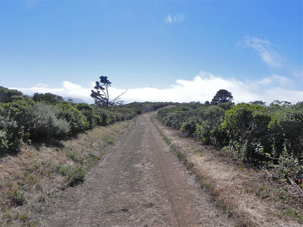
Mori Point Trail, Sweeney Ridge Pacifica Side, August 2011 (Jennifer Rycenga)
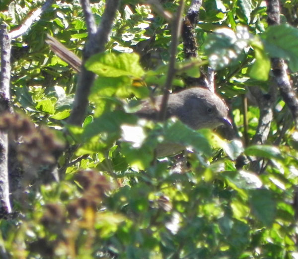
Wrentit, Mori Point Trail, Sweeney Ridge Pacifica Side, August 2011 (Jennifer Rycenga)
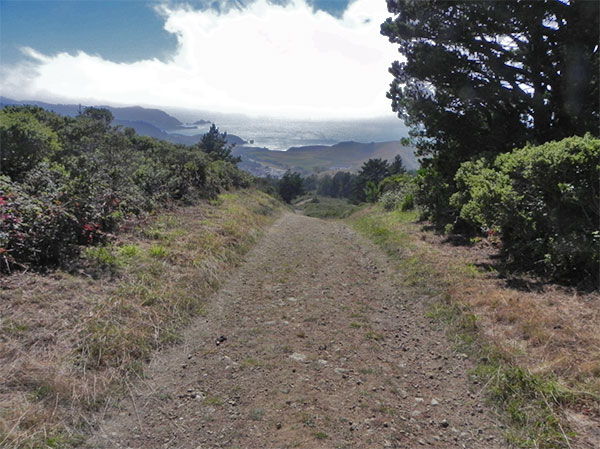
Mori Point Trail, looking southwest to the ocean in Pacifica, Sweeney Ridge Pacifica Access, August 2011 (Jennifer Rycenga)
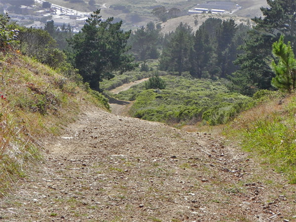
The Mori Point Trail is steep, gravely, and gorgeous. Sweeney Ridge Pacifica Side, August 2011 (Jennifer Rycenga)
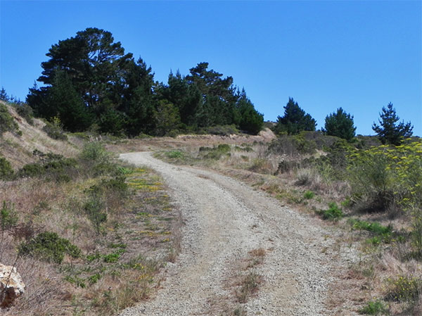
Baquiano Trail, near Pacifica entrance at end of Fassler Road, August 2011 (Jennifer Rycenga)
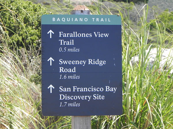
Baquiano Trail distances, Sweeney Ridge Pacifica entrance near end of Fassler Road, August 2011 (Jennifer Rycenga)
Author: Wanda Belland, revised Carol Miller, further revision Jennifer Rycenga
Uploaded:
August 17, 2011
Last Update:
November 25, 2020 8:27am
All content ©Sequoia Audubon Society and others
No use without written permission
