 Summer
 Fall
Winter

Spring
Summer
Fall
Winter

All or most of this park is closed due to damage from the CZU fire in 2020
San Mateo county does not offer many dirt roads for exploration, but Whitehouse Canyon Road begins to repair that deficiency. Accessed from SR1, Whitehouse Canyon goes east and passes through an impressive array of habitats: coastal terrace prairie, a pond, a lake, eucalyptus groves, mixed woodlands, coniferous forest, and redwood forest, in just over two miles, before it ends at a trailhead to Chalk Ridge. When there have been heavy rains in winter, the road may become muddy and even impassable without a sturdy four-wheel drive truck; this has hampered a few Christmas Bird Count teams in the area.
The turn-off for Whitehouse Canyon Road is not marked; it is frustratingly easy to drive by the area. If you are driving south on SR1, you will make your first left onto a dirt road after Rossi Road. Driving north on SR1, note that Whitehouse Canyon Road is directly across from one of the parking areas for Año Nuevo's Coastal Prairie bordering on Whitehouse Creek itself (if, when driving north, you pass the entrance signs for Costanoan Lodge and Rossi Road, you've gone too far).
Technically, much of this land is part of Año Nuevo State Park, but not all of it. Generally, the coastal terrace prairie sections are easily birded, and accessible. This road is used by residents, however, so search for turnouts if you do park here. As you drive along Whitehouse Canyon Road in the first few minutes, listen in spring for the sound of Grasshopper Sparrows; up to a dozen individuals have been heard in a single day! The first area deserving of your sustained attention, though, is a small, fenced-in reservoir/pond. Look for a turn-off to your right about .7 miles from SR1. While this water feature is one of the best birding gems here, it is challenging to bird. Overgrown areas make viewing places difficult to discern. When you walk to the end of the spur, you will see a makeshift trail to your left, which roughly circumambulates the pond. There are some vantage points to the water in the first few yards of this trail, if you walk right up to the cyclone fence. Because the waterfowl that use this pond are not used to being disturbed, they spook easily. Among the birds seen there in winter are Bufflehead, Ring-necked Duck, Ruddy Duck, Pied-billed Grebe, and American Coot. Bank Swallow has been seen here in summer, and Garth Harwood detected a Sora in 2010. From the turnoff, there is also a road going to your right. Do not attempt to drive this road, but walking it brings you to an eucalyptus grove that harbors expected winter warblers like Townsend's, Yellow-rumped, and the occasional Orange-crowned, as well as Hutton's Vireo. The area should be checked for more unusual overwintering warblers.
Proceeding along Whitehouse Canyon Road from this stop, in another .7 miles (1.4 from the starting point at SR1), you will see a dirt scrape parking area on your left. Park here and look across the road for a well-masked trailhead. An orange "Warning" post and a rusted metal stake are evidence that someone, at some time in the past, paid attention to this trail. While its beginning is marked by overgrowth (dominated by poison oak), it soon becomes broader. In about a quarter of a mile, you can spy a nice-sized body of water below you and to your right: this is Chandler Reservoir. This beautiful gem of a water feature, though, has not produced many bird species. Perhaps you, gentle reader, will be the one to make this a destination site by finding something unusual here. There is no direct access possible to Chandler Reservoir, but it is easily scoped from this trail.
The trailhead to the pond runs along a mild canyon edge, that also abuts onto multiple habitats; it is a transition zone into mixed woodland, but one that still brings you westward views of the ocean and, in particular, of Año Nuevo point, island, and coastal terrace prairie. As you continue your progress east along Whitehouse Canyon Road, you will experience further habitat shifts. In another .3 of a mile (1.7 from SR1), you will see a gated area on your left. This area, currently off-limits for habitat renewal, has the best mixed woodland birding in this zone, and the trail head that starts here winds to a meadow below. You do not need to go beyond the gates in springtime, though, to detect MacGillivray's Warbler, which likes the stands of poison oak near here. The best way to experience this trail in its totality is to participate in Sequoia Audubon Society's Año Nuevo Christmas Bird Count, when the park grants access to bird-counters. Do not endanger future access by walking the trail illegally; one day soon this will be accessible to all, if we refrain from using it now.
In another .6 of a mile (2.3 from SR1), the publicly available road ends at the trailhead for Whitehouse Ridge Trail. This steep trail winds through a young Redwood forest. Signs of earlier generations of logging and fires are discernable here. The birding is slow, the forest is dark, and the trail is steep and gravely. The reward is that if you make it to the top, on Chalk Ridge, you have the most phenomenal views of Año Nuevo possible. Do not attempt this hike in inadequate footwear. The birds you are likely to detect include some that are highly desirable, though, such as Northern Pygmy-Owl, Pileated Woodpecker, Brown Creeper, Varied Thrush, breeding Hermit Thrush, and, if all the stars align and the birding deities are capriciously upbeat, the mythical Spotted Owl is as likely here as anywhere in the county (in other words, not at all likely, but this is a good spot to supplicate the universe).
Speaking of owls, this area is excellent for night birds. It has habitat similar to Gazos Creek Road, in terms of mixed woodland contiguous to meadows and prairies - excellent hunting areas for owls. Great Horned, Western Screech, Northern Pygmy, and Northern Saw-whet Owls are all possible here. The most exciting owl here, though, is the Long-eared Owl. While it is not present every winter, and is really best listened for in the middle of the night, the Long-eared Owl has been detected near the gated trailhead (1.7 miles from SR1). Good luck, and observe all rules of safety and the ethics of birding should you attempt to owl here. In winter, Varied Thrush will also be out on this road, especially in the hours of the morning before full sunlight hits the road.
Once you have completed your tour of Whitehouse Canyon Road, return to SR1, take a right, and cover the few feet to Rossi Road. Take a right here (east), and enter into the realm of Costanoan Lodge and Campground. This area, while it has been changed by human interference, provides another wealth of mini-habitats that attract birds. Be on your best manners here, because this is technically private property, and we birders stop here on the company's sufferance.
There are public, open restrooms at both the Costanoan restaurant building (on the back side facing north) and the General Store building. Please clean off your boots before proceeding to use these restrooms if you are coming off the trails. Patronizing the general store and/or the restaurant is also good for advertising that birders are good neighbors and customers!
The campground and lodge areas have lawns, an equestrian stable, campgrounds, a 'farm' garden, and more. A good stretch of riparian bordering Whitehouse Creek can be accessed by walking back along the entrance road (do NOT park on the entrance road) and following the trailheads in toward the lush growth.
Because of the presence of horses and open lawns, there are always Brewer's and Red-winged Blackbirds, and European Starlings around the Costanoan grounds. This means birders should be alert for rarer members of the family, such as Yellow-headed and Rusty Blackbirds or Grackles of any species. A walk around the campground and cabins brings one to edges between habitats. Western Bluebirds, which are not an easy species to see predictably on the coast, are regular here at Costanoa. From the Equestrian Area, there is a footpath through a eucalyptus grove to a spot where one can (with great caution) cross SR 1 and continue on the trailhead to Franklin's Point (see entries in this guide for Gazos Creek Beach Access and Año Nuevo Coastal Terrace Prairie for more detail on these areas west of SR1). In general, and especially for visiting birders who might want a camping experience along the coast, this area is worthy of further exploration and documentation. It is one or two startling rarities away from creating a stir in the local birding community.
Another area contiguous to Whitehouse Canyon Road involves another relatively inaccessible body of water, Lake Elisabeth. This rather substantial lake is located east of SR1 between Cascade Ranch and Whitehouse Canyon Road. There is a small pull-off on the east side of SR 1, just north of where Cascade Creek crosses under SR1. You can walk into a visible willow thicket near the lake, which has proven to be a good site for Yellow-breasted Chat in spring.
Mallard, Ring-necked Duck, Bufflehead, Ruddy Duck, California Quail, Pied-billed Grebe, Turkey Vulture, Northern Harrier, White-tailed Kite, Cooper's Hawk, Red-shouldered Hawk, Red-tailed Hawk, American Kestrel, Peregrine Falcon, American Coot, Sora (uncommon), Band-tailed Pigeon, Mourning Dove, Great Horned Owl, Western Screech-Owl, Northern Pygmy-Owl, Northern Saw-whet Owl, Anna's Hummingbird, Red-breasted Sapsucker (winter), Downy Woodpecker, Hairy Woodpecker, Nuttall's Woodpecker (unusual at this location), Olive-sided Flycatcher, Pacific-slope Flycatcher, Black Phoebe, Say's Phoebe, Hutton's Vireo, Warbling Vireo, Western Scrub-Jay, Steller's Jay, Common Raven, Barn Swallow (nesting easily observed at Costanoa, present in winter, too, in low numbers), Tree Swallow (sometimes in winter, too), Cliff Swallow, Bank Swallow (uncommon), Wrentit, Chestnut-backed Chickadee, Red-breasted Nuthatch (uncommon), Pygmy Nuthatch, Brown Creeper, Pacific Wren, Bewick's Wren, House Wren, Golden-crowned Kinglet, Ruby-crowned Kinglet, European Starling, California Thrasher (along upper ridge line), Western Bluebird, Swainson's Thrush, Hermit Thrush, Varied Thrush, American Robin, Townsend's Warbler, Yellow-rumped Warbler, Orange-crowned Warbler, Black-throated Gray Warbler (migration), MacGillivray's Warbler, Common Yellowthroat, Grasshopper Sparrow, Spotted Towhee, California Towhee, Savannah Sparrow, Fox Sparrow, Song Sparrow, White-crowned Sparrow, Golden-crowned Sparrow, Dark-eyed Junco, Western Tanager (migration), Lazuli Bunting (migration), Red-winged Blackbird, Tricolored Blackbird, Brewer's Blackbird, Brown-headed Cowbird, House Finch, Purple Finch, American Goldfinch, Lesser Goldfinch, Red Crossbill, Pine Siskin
In this guide, "rarities" are defined as those species given an County Abundance Code of 4, 5, or 6.
Rough-legged Hawk (2019), Long-eared Owl, Black Swift (2013), Red-naped Sapsucker (2012), Pileated Woodpecker, Prairie Falcon (2010, 2017), Loggerhead Shrike (2017), Eastern Phoebe, Western Kingbird (2010), Yellow-breasted Chat (2005), Chestnut-sided Warbler (2014), Lark Sparrow (2010), White-throated Sparrow (2019), Lawrence's Goldfinch (2010)
These sites are located on SR1 near Año Nuevo. Rossi Road provides access to Costanoan Lodge, and Whitehouse Road is the closest turn to the east, located south of Rossi Road.
Red Markers: Parking Area or Trail Head
Hover mouse pointer over marker, or click marker, for pin identification.
Use + or - buttons to change map zoom. Click & Drag to pan.
There are no fees associated with using this area for birding. However, if birders are going to bird the territory at Costanoan Lodge and Campground, a purchase at the General Store or at the restaurant is a polite gesture in exchange for the convenience of their restroom! Fees for camping or lodging there are available by contacting Costanoa directly.
There are no official hours for Whitehouse Canyon Road, which is a public road for its first 2.3 miles. Costanoan is a campground, so it too, if open at all hours. However, it is best for non-lodgers to steer clear of the campground after dark.
There are the usual hazards: poison oak is endemic and abundant. Mountain Lions use this habitat. There are ticks in grassy areas. Trails can be steep and slippery. When using pullouts along SR1, be aware that car-break-ins along this highway are frequent. Do not leave valuables in your car, and do not leave optical equipment in view.
Much of this area contains a mix of public and private lands. Be considerate of others, especially landowners and the proprietors of Costanoa, when using these areas.
There are bathrooms at Costanoan Lodge and General Store; at this latter location one can buy cold drinks, environmentally (if not nutritionally) sound chocolate bars, and other delectable delicacies. There are more extensive provisions in Pescadero, about 10 miles north. The restaurant at Costanoa is a classy kind of place, likely not well-suited to your hiking boots. But if you are camping here you can save one respectable outfit for a nice meal at the end of the day.
Accessibility information is currently not available for this location.
Recorded Information about Año Nuevo: 650-879-0227
Año Nuevo Park Office (do NOT use this number for Seal Walk reservations): 650-879-2025
Official Park Website: http://www.parks.ca.gov/?page_id=523
Hotspots in eBird for Whitehouse Road and Costanoa Lodge are numerous. You can use the general Año Nuevo site, but it is preferable to use one of the three more specialized hotspots. Costanoa Lodge has data in 25 of 48 time quadrants, representing just over 100 species. Whitehouse Cyn. Rd.--lower has data in 12 of 48 time quadrants, while the Whitehouse Cyn. Rd.--upper hotspot is struggling for data, with a mere eight of forty-eight quadrants showing data. These are habitat rich sites that deserve more sustained attention.
In addition to the general Año Nuevo site, there is a Cascade Ranch place marker in iNaturalist.
This area was devastated by the CZU Complex Fires in August-September 2020. Please join the iNaturalist project charting the response to this fire - the largest in southwestern San Mateo county in over a century - by visiting its home page here.
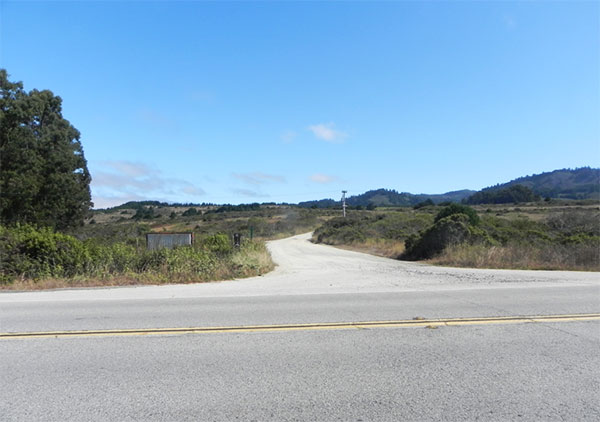
Unmarked entrance to Whitehouse Canyon Road, looking east from SR1, August 2011 (Jennifer Rycenga)
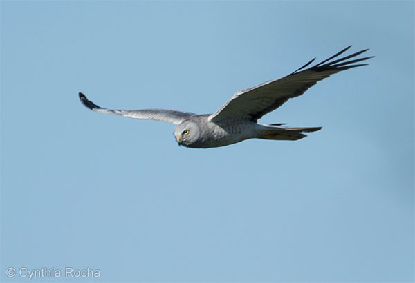
Northern Harrier, Whitehouse Creek, April 2015 (Cynthia Rocha)
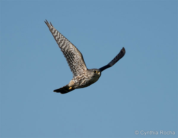
Merlin, Whitehouse Creek, April 2015 (Cynthia Rocha)
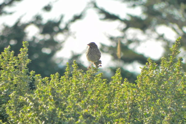
Savannah Sparrow, Whitehouse Canyon Road, near fenced pond turnoff, August 2011 (Jennifer Rycenga)
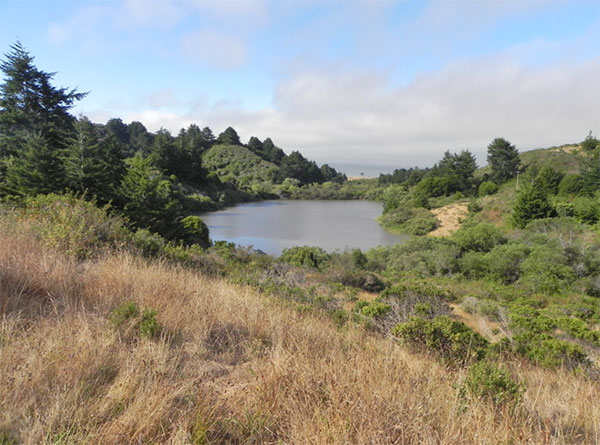
Fresh-water lake in the middle of Whitehouse Canyon area. If you look carefully you can see the two windswept trees that define the Cascade Creek trail (see Año Nuevo - Coastal Terrace Prairie entry in this guide), and the ocean beyond. This well-hidden lake, for all its beauty, has not been productive for birds. August 2011 (Jennifer Rycenga)
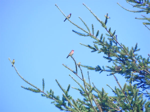
Purple Finches and American Goldfinches, Whitehouse Canyon Road, August 2011 (Jennifer Rycenga). All of the areas connected with Año Nuevo feature common Purple Finch
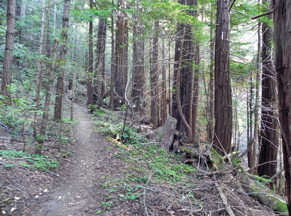
Trail connecting Año Nuevo to Big Basin shows evidence of both logging and fires in its history. While this may not be the most awe-inspiring Redwood forest you'll visit, it could be one of the most instructive concerning this gigantic tree's life cycle. Whitehouse Canyon Road, Año Nuevo trailhead heading southeast, August 2011 (Jennifer Rycenga)
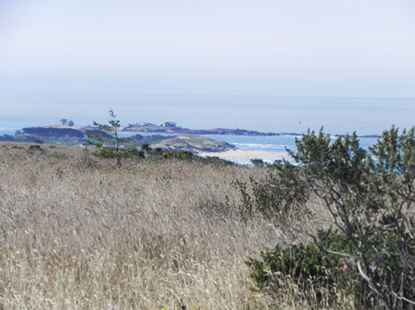
Año Nuevo Island, seen from Whitehouse Canyon Road, August 2011 (Jennifer Rycenga)
Author: Leslie Flint and Jennifer Rycenga
Uploaded:
August 27, 2011
Last Update:
May 12, 2021 1:57pm
All content ©Sequoia Audubon Society and others
No use without written permission
